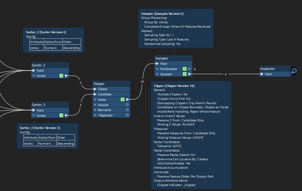
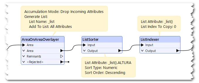
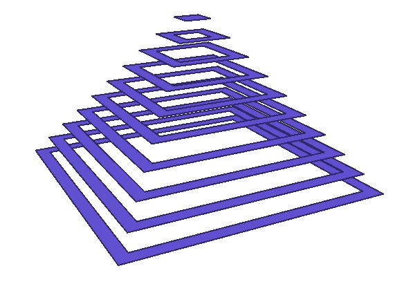
Good morning, friends. I have the following FMW. I want to cut the different geopack entries so that the top one cuts the one immediately below, creating a sort of pyramid that corresponds to the building's heights. I don't know what I have wrong with the custom transformer.In this case, there are this number of heights; in others, there are more or less, meaning they vary.Thank you.

I have no idea if this will work on real data but this is what I tried and had decent results. 

I started by sorting the storeys by number with top story first - Feed all features into the Clipper and Candidate ports of the clipper - set the “Overlapping Clipper” to “Clip Interim Results”.

After that I sampled the last feature per storey. 


I suspect the logic is flawed when it comes to real world data but could be a good starting point


Hi ​@julian_tala ,

If I understand your goal correctly, this could work.

  1. AreaOnAreaOverlayer: Input all the storey areas together into an AreaOnAreaOverlayer and populate attributes into a list attribute.
  2. ListSorter: Sort the list elements by ALTURA numeric descending.
  3. ListIndexer: Extract the first element (index = 0) of the list to restore the attributes for each storey. 
Result: z = ALTURA


Good morning. Thank you all for your interest and suggestions. I'm going to try both suggestions.Long live FME!