Question

GeoTiff Convert to Shape File


Forum|alt.badge.img+5

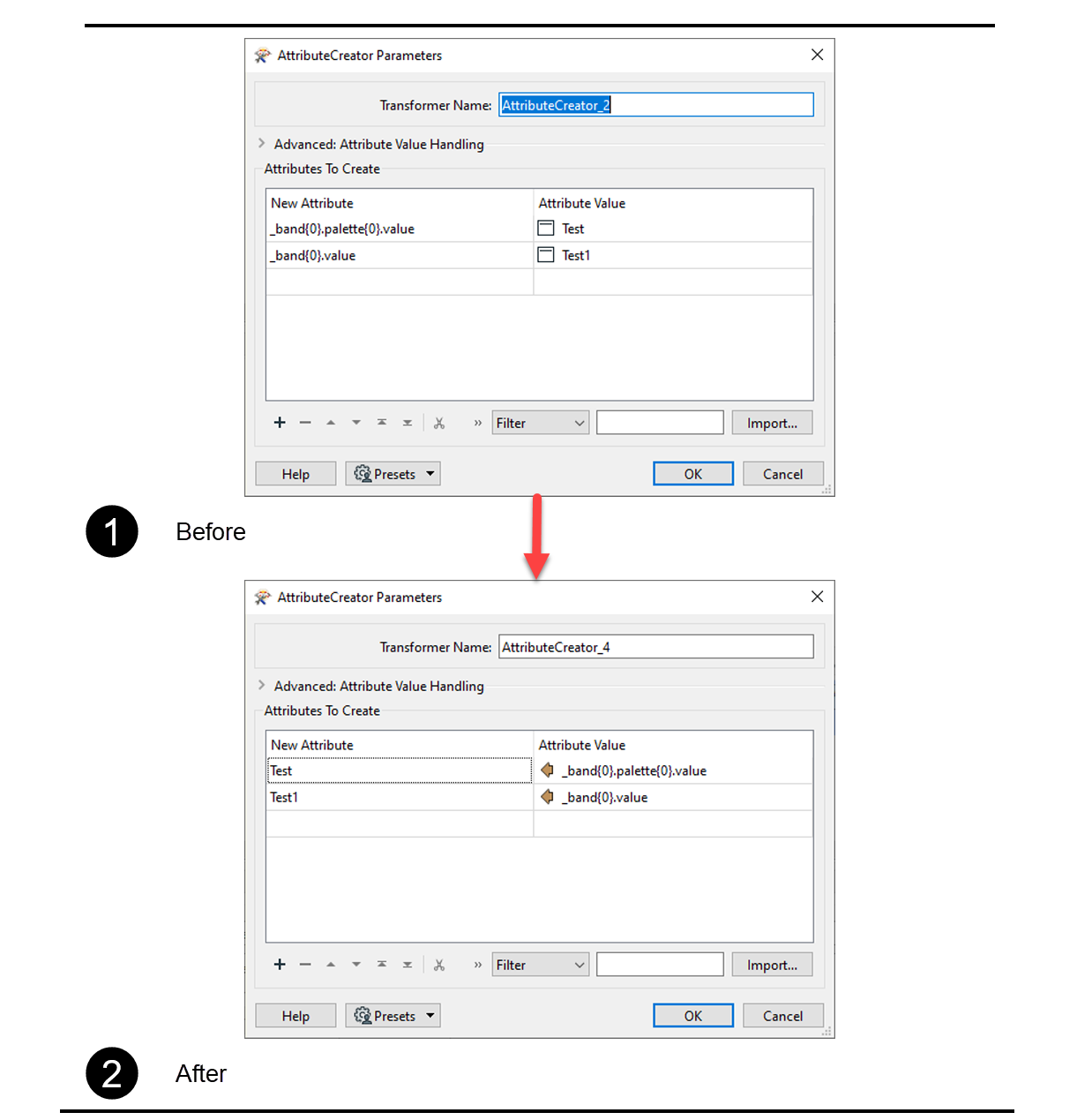
I have Geotiff file and I need to convert in shape file with data

I am new in this so I don't know how to Extract fields and attributes from Geotiff +


this is the file


https://www.nhc.noaa.gov/gis/inundation/inundation.zip

12 replies

nielsgerrits
VIP
Forum|alt.badge.img+54

Do I understand you want to convert the rastercells to points or polygons? This can be done but will result in a lot of points / polygons. About 5.000.000 for this raster.

Steps how you can do this:

  • Reader or FeatureReader to read the raster.
  • RasterCellCoercer to convert the rastercells to points or polygons.
  • AttributeCreator to convert the raster cell value to attribute. In this case _band{0}.value.
  • Writer or FeatureWriter to write the result to shape.

Forum|alt.badge.img+5
  • Author
  • June 27, 2022

give me null Values

image


nielsgerrits
VIP
Forum|alt.badge.img+54
asadamjad wrote:

give me null Values

image

Correct. The values are in the list "case _band{0}.value" so you must create an attribute using the AttributeCreator where value is case _band{0}.value.


You can see this in the Feature Information window in the Visual Preview or Data Inspector.


Forum|alt.badge.img+5
  • Author
  • June 27, 2022

still not getting it


nielsgerrits
VIP
Forum|alt.badge.img+54
nielsgerrits wrote:

Do I understand you want to convert the rastercells to points or polygons? This can be done but will result in a lot of points / polygons. About 5.000.000 for this raster.

Steps how you can do this:

  • Reader or FeatureReader to read the raster.
  • RasterCellCoercer to convert the rastercells to points or polygons.
  • AttributeCreator to convert the raster cell value to attribute. In this case _band{0}.value.
  • Writer or FeatureWriter to write the result to shape.

Attached workspace demonstrating this.

2022-06-27_16h00_33


Forum|alt.badge.img+5
  • Author
  • June 28, 2022
nielsgerrits wrote:

Attached workspace demonstrating this.

2022-06-27_16h00_33

work perfectly fine

can we merge features with similar category

as in one multipolygon for each category

image
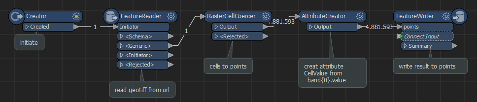
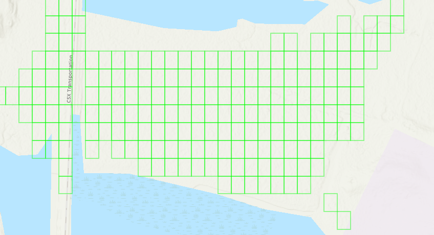
it's like each pixel has been inserted separately as a record

this doesn't seem right

adjoining features need to be merged as a single polygon

that way, they will represent a single region


nielsgerrits
VIP
Forum|alt.badge.img+54
nielsgerrits wrote:

Attached workspace demonstrating this.

2022-06-27_16h00_33

Merging adjoining polygons with similar attributes can be done using the Dissolver.


Forum|alt.badge.img+5
  • Author
  • June 28, 2022
nielsgerrits wrote:

Attached workspace demonstrating this.

2022-06-27_16h00_33

but i need in polygon


Forum|alt.badge.img+5
  • Author
  • June 28, 2022
nielsgerrits wrote:

Attached workspace demonstrating this.

2022-06-27_16h00_33

i am new and i have no idea how can I do that


nielsgerrits
VIP
Forum|alt.badge.img+54
nielsgerrits wrote:

Attached workspace demonstrating this.

2022-06-27_16h00_33

I think the best advise I can give is to work through the FME Academy first, to get up to speed working with FME.


Forum|alt.badge.img+5
  • Author
  • June 28, 2022
nielsgerrits wrote:

Attached workspace demonstrating this.

2022-06-27_16h00_33

i am but atm this work is in urgent situation


danminneyatsaf
Safer
Forum|alt.badge.img+12
asadamjad wrote:

still not getting it

Hi @asadamjad​ Currently in your AttributeCreator, you are assigning "_band{0}.value" to the New Attribute parameter. Instead of assigning it to the New Attribute parameter, try assigning it to the Attribute Value parameter. You can then assign the name of the attribute in the New Attribute parameter.

image


Hope this helps! - Dan M


Cookie policy

We use cookies to enhance and personalize your experience. If you accept you agree to our full cookie policy. Learn more about our cookies.

 
Cookie settings