Question

GeometryValidator reports in FileGDB but not in SHP file


juanmahere
Supporter
Forum|alt.badge.img+12

2022-02-18_13-29-27Hi!

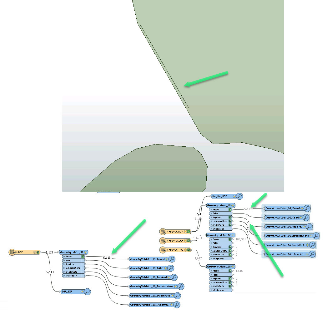
Using FME Desktop 20202.0, I cannot explain to myself why GeometryValidator transformer can miss a geo-issue when using ShapeFile format while can catch it for the same dataset in FileGDB format. Attaching screenshot.


Any ideas?

Thanks,

Juanma,

3 replies

david_r
Celebrity
  • March 8, 2022

Generally speaking, the FGDB format implements a snapping grid (tolerance and precision in the feature class definition) that might modify the geometry very slightly when written. If the feature class tolerance and/or precision is not right for the data, it can lead to issues where geometries with very tight tolerances are rendered invalid (e.g. self-intersections) by the snapping grid.

Shape files do not implement such a snapping grid, data is saved as-is in full precision.


juanmahere
Supporter
Forum|alt.badge.img+12
  • Author
  • Supporter
  • March 8, 2022

Thanks @david_r​ , but that "hole" that you can see on the screenshot is located on both formats, so I expected the GeometryValidator could find for both datasets as well. Also MapINFO (miTAB) was used and GeometryValidator detected it.


Forum|alt.badge.img+2

@juanmahere​ Under the covers, MapInfo is also an interger based coordinate system (Stores coordinates natively as 32-bit integers. Yields 10 digits of precision) . Extended TAB is 64bit I believe.


Cookie policy

We use cookies to enhance and personalize your experience. If you accept you agree to our full cookie policy. Learn more about our cookies.

 
Cookie settings