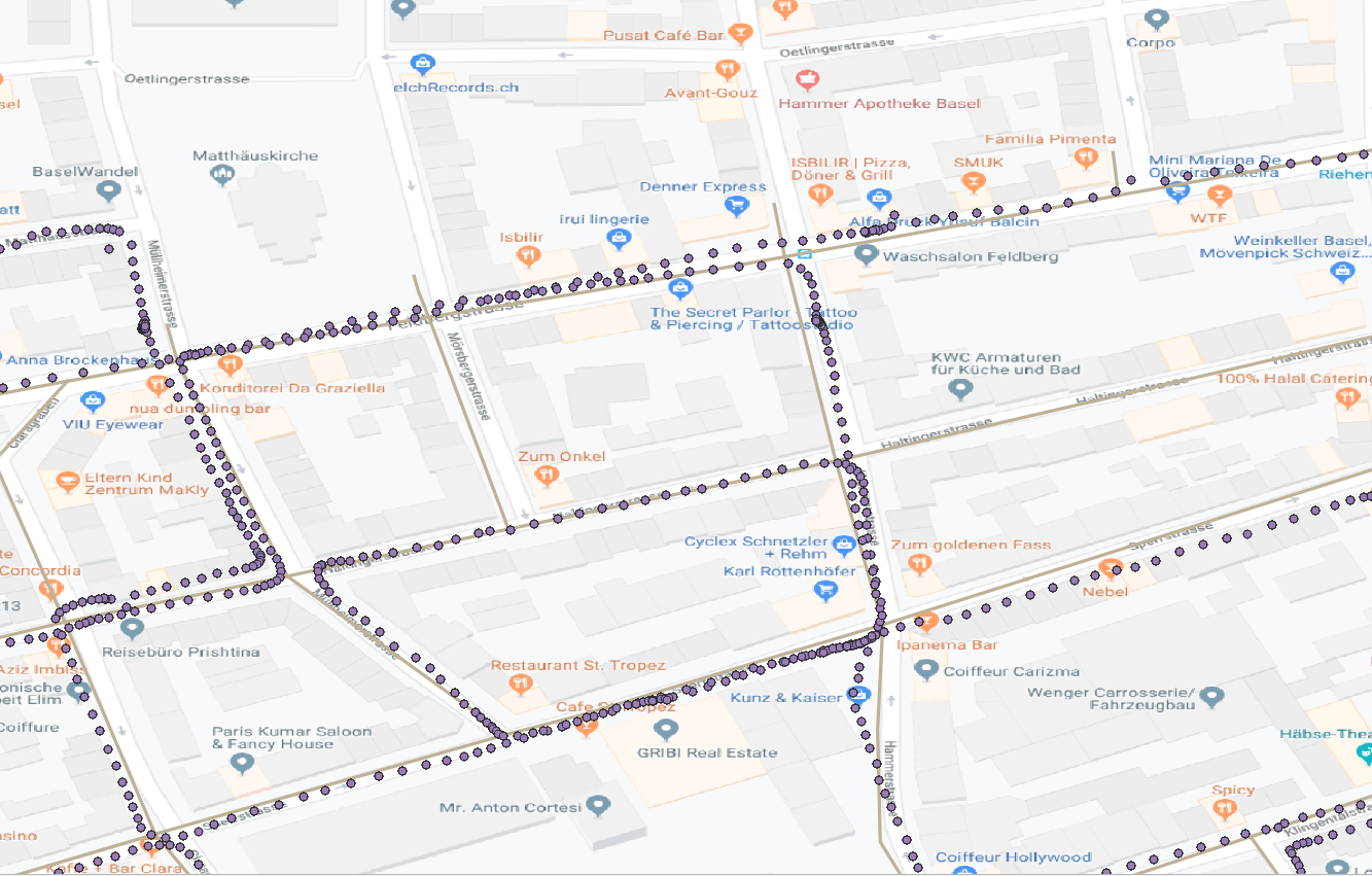
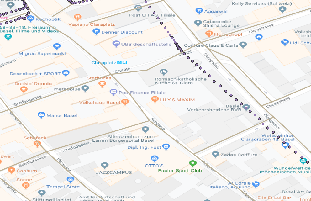
When the points cross a road that is not travelled NeighborFinder won't know that it's not travelled. However, if you make a line out of the points you can filter away results that differ too much in angle.
I think what might work for you is:
- GeometryExtractor on the points to store the original point geometry
- AnchoredSnapper using the lines as anchor
- GeometryReplacer to get the original points back, but now they have the attributes of the line they snapped to.
@jugoslaviaa I think what you want is to match the track of the GPS points, not the individual points. If you match the individual points, then you'll probably get the cross streets matched where the GPS trajectory crosses an intersection. So you might want to try using:
- LineBuilder to string the GPS points into a GPS track
- Matcher or ChangeDetector - use the new ChangeDetector and the Fréchet distance (2019 and up)
Exactly, I would like to snap this GPS trajectory to road network. I am digging the ChangeDetector but could figure out. Road network should go to the Original port and lines from GPS track to the revised or the otherway?
@jugoslaviaa I think I should have suggested Matcher instead of ChangeDetector in this case. I edited the comment above to reflect this... If you upload a small sample dataset as, say, a Geopackage we might be able to experiment a bit