I have two feature classes one is point data another one line data that is Road and
I need to select only which points are placed in between DC road.
Refer Below Image for more clarity
Please suggest...


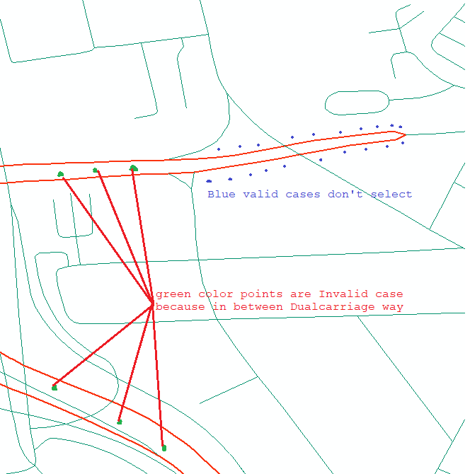
I have two feature classes one is point data another one line data that is Road and
I need to select only which points are placed in between DC road.
Refer Below Image for more clarity
Please suggest...
No account yet? Create an account
Enter your E-mail address. We'll send you an e-mail with instructions to reset your password.


