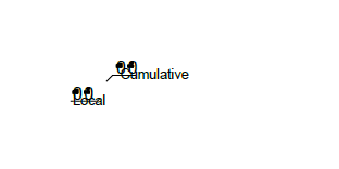
We are trying to create geopdfs for different defined area having multiple devices , features in them. Adding labels to symbols using LabelPointReplacer Parameters and set the label scale that most of the area fits to it. But few areas are having labels that are overlapping with the symbols as shown below

Is there a way to adjust the scale based on different areas.


