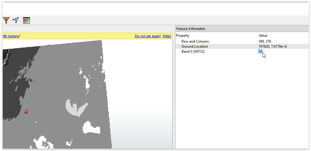
I would like to use the pixel values from a raster to proceed with different kind of analysis without converting to vector data. As you can see in the screenshot, in this case is the value from Band 0 (INT32) such as 50.
Best regards,
Felipe Verdú
This post is closed to further activity.
It may be an old question, an answered question, an implemented idea, or a notification-only post.
Please check post dates before relying on any information in a question or answer.
For follow-up or related questions, please post a new question or idea.
If there is a genuine update to be made, please contact us and request that the post is reopened.
You can create a point, offset or affine it by values like target_row,target_col. Using of course the raster extents (lower left corner for instance) and then use a PointOnRasterValueExtractor to extract the values at the target location.
@gio and @danilo_fme: First of all, thans for your comments. I prefer not to use vector data but raster data since this is more effective and practical in my workflow. It is like in ArcGIS/Python using raster directly.
I solved this thing using a RasterExpressionEvaluator. It was my little knowledge of implementing if statements in the expression evaluator what hinder my understanding. Thanks, @danilo_fme