Hi,


Attached I have two sets of data with several polygons. The two are almost identical, but one has different polygons or more polygons than the other. How can I do it using FME? I already used the Spatial Relator transformer and change detector transformer but the results were not good.


I want to know the difference between the two, that is what appeared in one and what disappeared in the other. can anybody help me?


Thanks

Have you tried the ChangeDetector?


Have you tried the ChangeDetector?

Yes, I tried. I believe that works fine when one polygon or polygons like singlepart. In my case no work very well. Thank´s


I´m wainting for more suggestions.


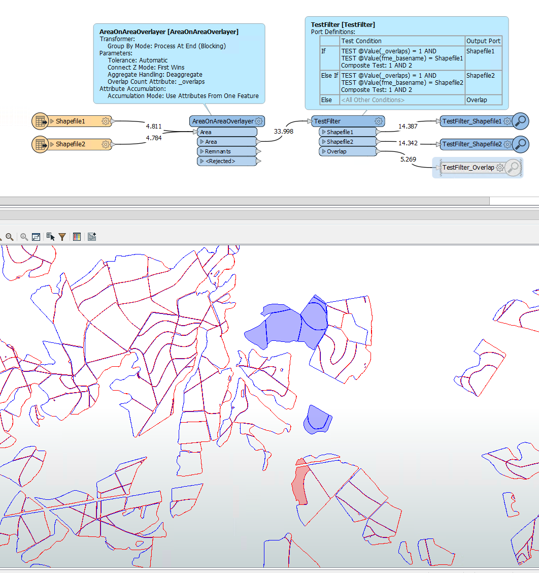
Unfortunately, the shapes in the two shapefiles are not almost identical.

When I apply an AreaOnAreaOverlayer, there are small differences between most of the shapes.

It appears the data is slightly shifted between both data sets.

image


Unfortunately, the shapes in the two shapefiles are not almost identical.

When I apply an AreaOnAreaOverlayer, there are small differences between most of the shapes.

It appears the data is slightly shifted between both data sets.

image

Yes, correct! slightly shifted. The little difference is not important. The Important is the polygons that no have in other dataset, in other words the difference between both.


Thank´s


The little difference is important to FME. Because of the little difference, the usual tools like ChangeDetector and Matcher do not work. The little difference makes it much more difficult to answer your question.


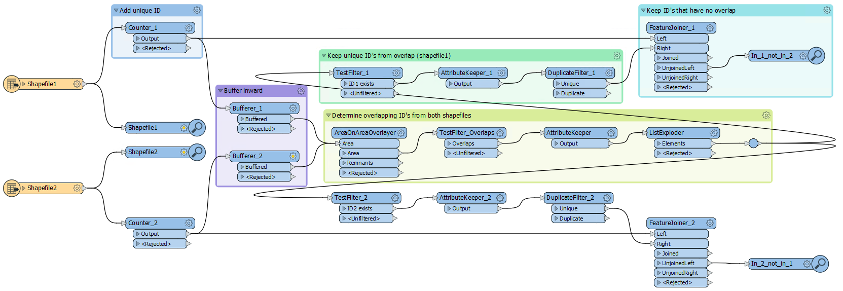
This seems to work reasonably well. I cannot guarantee completeness though.

  • Give each feature a unique ID
  • Make all featues somewhat smaller (buffer inward ) to prevent overlaps between features from the two datasets that should not overlap
  • Determine the ID's of features that overlap
  • The ID's that are NOT in the overlap are unique to one input file

Almost_identical_shapefiles

Thank´s geomancer!!


work reasonably well. I will test with others datasets.


Reply