
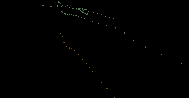
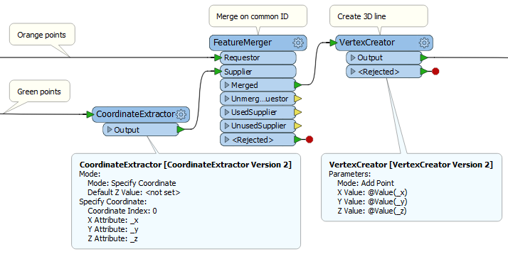
I want to connect the orange and green points together to form 3d polylines (I'm in effect wanting to create a ray). The orange points represent a point on the ground and the green points represent the point in space where an image was taken of the point on the ground.

If there's a common ID between the green and orange points, you can for example do:

  • CoordinateExtractor on the green points
  • FeatureMerger on the common ID, the orange points as the Requestor
  • After the Merged output, use a VertexCreator to add the vertex from the green point to the orange point, thereby making a line.

You could also consider using the NeighborFinder for an alternative solution.


Reply