Hello Learned Friends,
I have a Point layer where I need to convert each Point feature into a Polyline feature which traces along a set length (say 25 metres) of the nearest neighbouring polyline feature from a separate layer.
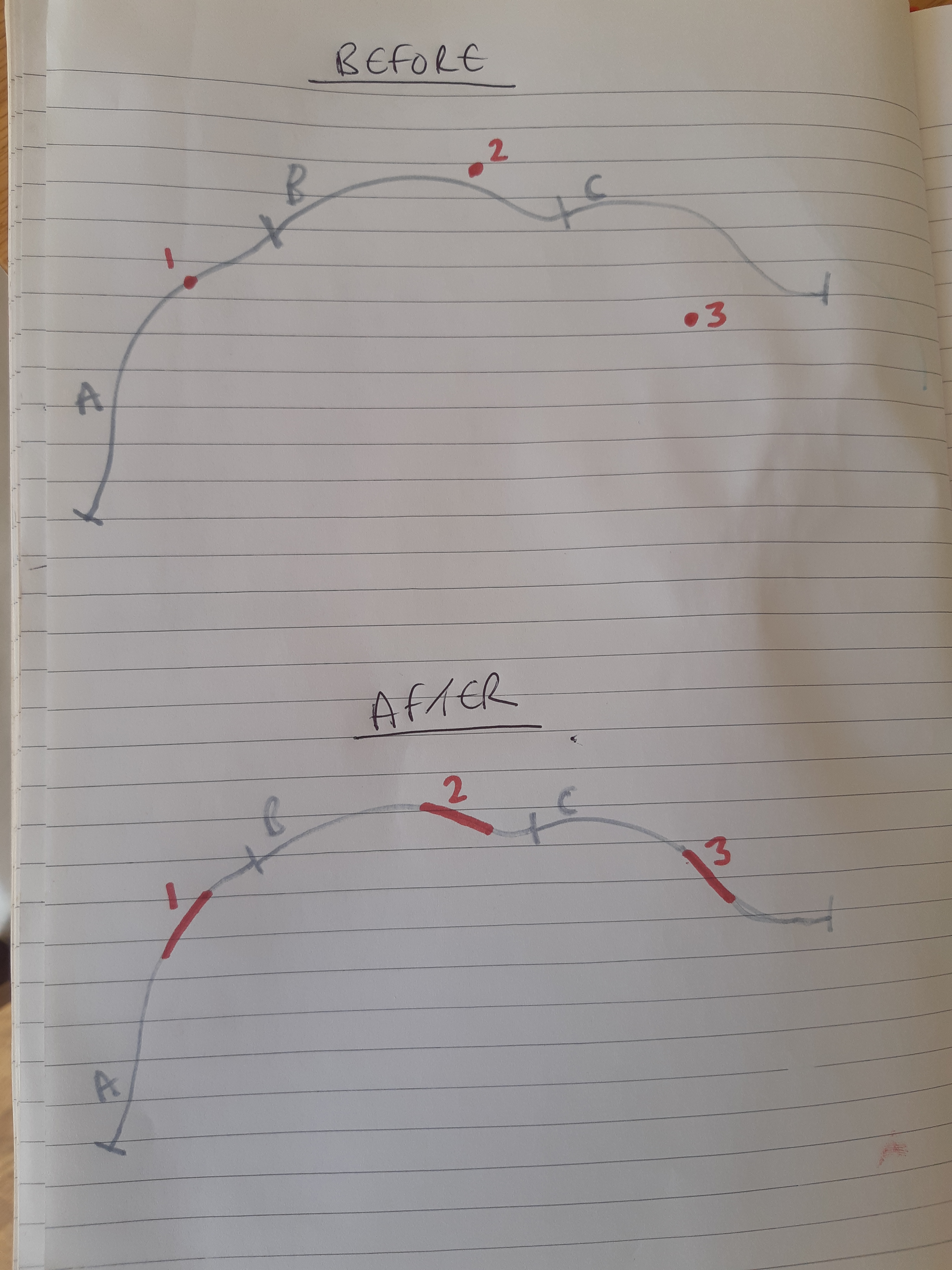
In the crude example below, the BEFORE scenario details an example of my starting position, whereby I have 3x Points (in red), plus 3x Polyline reference features (in grey).
The AFTER scenario details what I am attempting to achieve, and ideally the grey Polyline features (A,B, and C) will become split features along the length where the new red polyline features have been inserted.
Does anyone have any ideas of how i can achieve this?

Many thanks,
RB


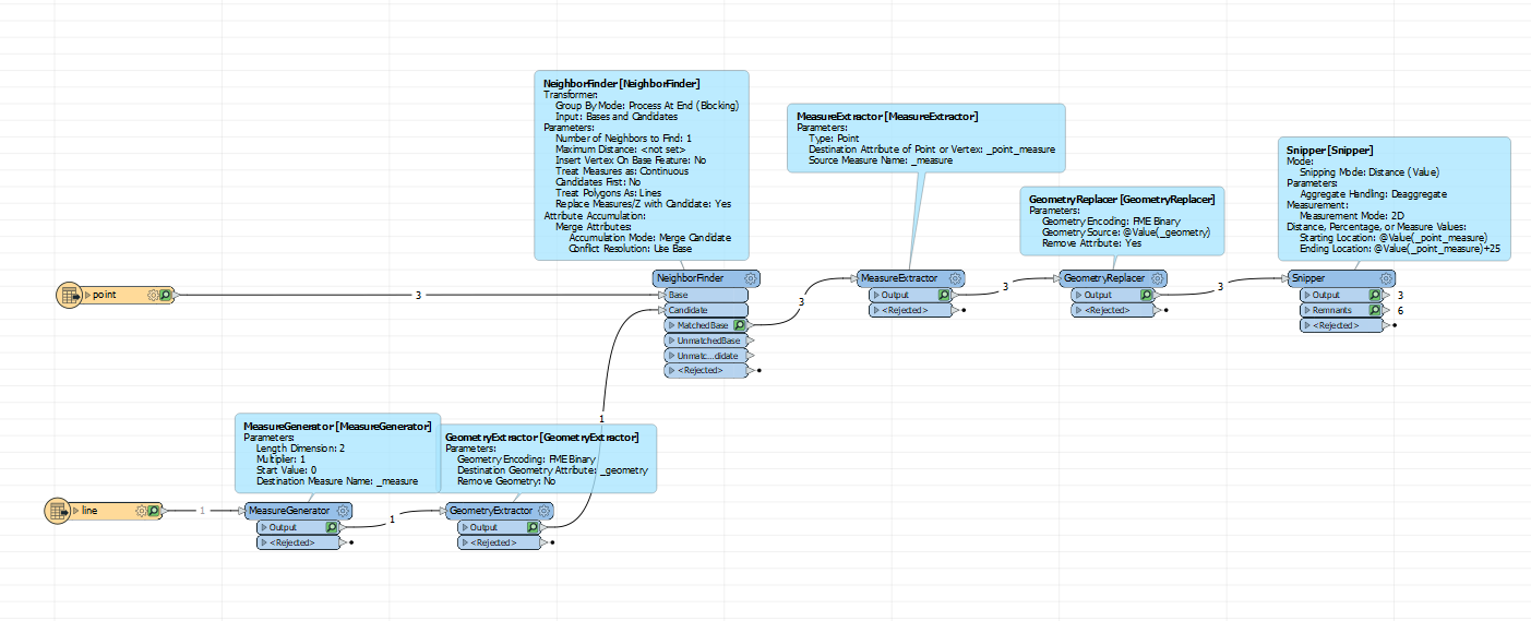
 If you generate a measure on the line you can use the snipper to get a part of that line. The Neighborfinder finds the measure of the startpoint on the line. The endpoint will be the startpoint + 25.