Solved

Create a polygon based on input attributes


fmesafe.podpora
Contributor
Forum|alt.badge.img+11

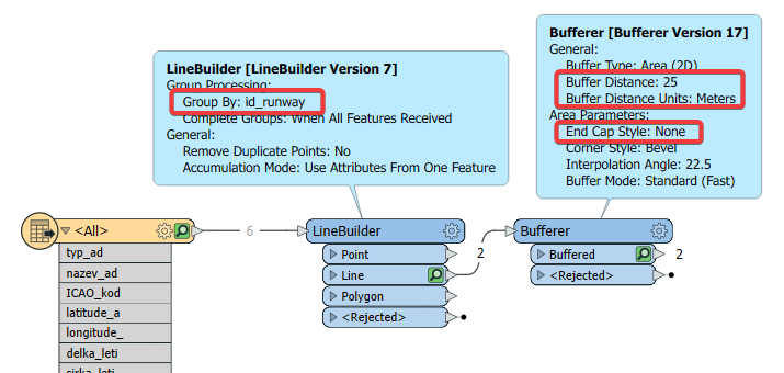
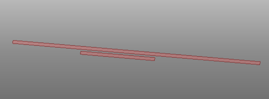
Hello. Could someone advise? I have an airport runway and for each runway I have a runway threshold coordinate - start and end. I also know the length and width of the runway between these runway thresholds. I would need to graphically create a polygon that will create the correct visualization for me based on these input attributes. The output format will be a shapefile. The dates of each runway are several times, because depending on the direction from which I land, I have the name of the runway. In reality, it is 2 points of each runway (start and end) and their one length and width. Thank you very much


Best answer by david_r

fmesafe.podpora wrote:

Thank you for answer. This is the result from FME from my input data? Would it be possible to show the workspace? Thank you

Sure thing, it's indeed using your sample data. Note that I've simply hardcoded a runway width of 25 meters:

image

View original
Did this help you find an answer to your question?

5 replies

david_r
Celebrity
  • November 14, 2023

You could join the two points into a line (e.g. using a LineBuilder with a Group By on the runway ID) and then use the Bufferer to convert the line into a polygon using the runway width divided by 2. You probably want to use the "None" end cap style in the Bufferer. Sample result:

image


fmesafe.podpora
Contributor
Forum|alt.badge.img+11
david_r wrote:

You could join the two points into a line (e.g. using a LineBuilder with a Group By on the runway ID) and then use the Bufferer to convert the line into a polygon using the runway width divided by 2. You probably want to use the "None" end cap style in the Bufferer. Sample result:

image

Thank you for answer. This is the result from FME from my input data? Would it be possible to show the workspace? Thank you


david_r
Celebrity
  • Best Answer
  • November 14, 2023
fmesafe.podpora wrote:

Thank you for answer. This is the result from FME from my input data? Would it be possible to show the workspace? Thank you

Sure thing, it's indeed using your sample data. Note that I've simply hardcoded a runway width of 25 meters:

image


fmesafe.podpora
Contributor
Forum|alt.badge.img+11

Thank you very much, I will try it tomorrow and let you know the result.


fmesafe.podpora
Contributor
Forum|alt.badge.img+11

Your solution works great, thank you very much.


Cookie policy

We use cookies to enhance and personalize your experience. If you accept you agree to our full cookie policy. Learn more about our cookies.

 
Cookie settings