Question

Convert Digital Terran Model TIFF to TAB

  • February 3, 2022
  • 2 replies
  • 91 views

nedwaterman
Contributor
Forum|alt.badge.img+9

I'm using FME 2021 to convert Environment Agency 2m DTM data into either shapefile or mapinfo tab, primarily for consumption in InfoWorks.


fmeimage 

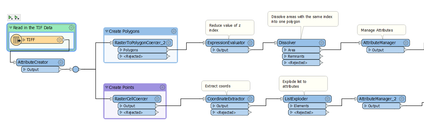
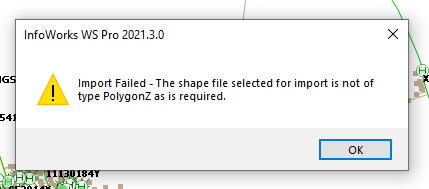
I've used the RasterToPolygonCoercer to produce shapefiles but my users cannot import them in Infoworks. They receive the attached error.


errorNot sure if its because I'm using a TIFF reader rather than GeoTIFF?


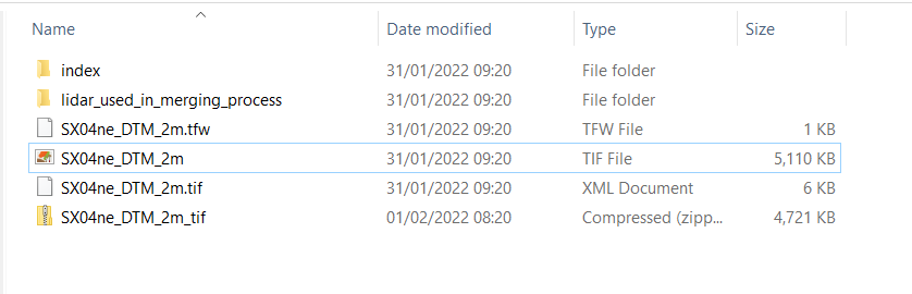
The original files look like this:


originalfiles 

Any help appreciated - new to this aspect of FME!

2 replies

daveatsafe
Safer
Forum|alt.badge.img+19
  • Safer
  • 1637 replies
  • February 3, 2022

Hi @nedwaterman​,

Please try using a 3DForcer transformer on the polygons to set their Z value to the elevation from the TIFF data. This should produce the PolygonZ type that InfoWorks is looking for.


nedwaterman
Contributor
Forum|alt.badge.img+9
  • Author
  • Contributor
  • 69 replies
  • February 7, 2022

Hi @nedwaterman​,

Please try using a 3DForcer transformer on the polygons to set their Z value to the elevation from the TIFF data. This should produce the PolygonZ type that InfoWorks is looking for.

Just the ticket - thanks very much!