Solved

Compare two different geometry datasets

  • May 14, 2019
  • 3 replies
  • 443 views

Hi guys,


A newbie here! I have the following question/problem:


I have to geometries sources, I have a geojson file with a specific geometry (this is an house with 4 corners, 5 coordinates), the second dataset is a city dataset that contains land parcels. The challenge is now to compare the two sources and become as outcome the affected land parcels, with affected land parcels I mean those parcels where the house is placed/located.

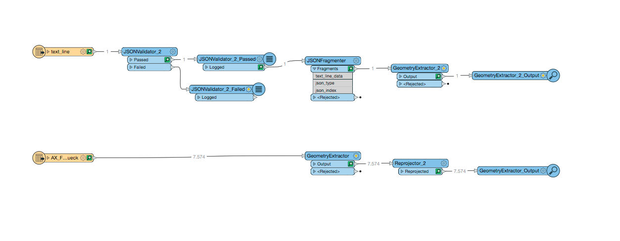
In the first picture you can see what i did so far, i parsed the geojson file and I extracted a geometry, in the second source i extracted the land parcels geometries and adapted the coordinate system (LL84). In the second and third picture you can see both the graphics, so it works very well. Now i should "only" compare the geometries and get the affected land parcels.


Thank you in advance for your help!


Best answer by fmelizard

Hi @dummknopf You can also use a SpatialFilter or SpatialRelator to identify which parcels have points or polygons that intersect, overlap, or are contained within.

This post is closed to further activity.
It may be an old question, an answered question, an implemented idea, or a notification-only post.
Please check post dates before relying on any information in a question or answer.
For follow-up or related questions, please post a new question or idea.
If there is a genuine update to be made, please contact us and request that the post is reopened.

3 replies

erik_jan
Contributor
Forum|alt.badge.img+22
  • Contributor
  • 2179 replies
  • May 14, 2019

Assuming the house is in one parcel I would do the following:

Replace the house geometry by a center point (CenterpointReplacer).

Find the Parcel in which the center point is (PointonAreaOverlayer), followed by a Tester on the Area output (test for _overlaps > 0).

Hope this helps.


fmelizard
Safer
Forum|alt.badge.img+20
  • Safer
  • 3719 replies
  • Best Answer
  • May 14, 2019

Hi @dummknopf You can also use a SpatialFilter or SpatialRelator to identify which parcels have points or polygons that intersect, overlap, or are contained within.


  • Author
  • 1 reply
  • May 21, 2019

Hi @dummknopf You can also use a SpatialFilter or SpatialRelator to identify which parcels have points or polygons that intersect, overlap, or are contained within.

Thank you very much @danatsafe! I adopted your approach and it works like a charm!