This article may be of assistance: How to Convert DGN to Shapefile (CAD Levels to GIS Attributes) (safe.com)
How quickly you can convert really depends on how complex your dgn files are. The dgn file name will be stored in igds_basename, and the elevation can be extracted using the CoordinateExtractor.
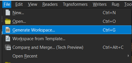
I would suggest using the Generate Workspace function in FME as the starting point, then build out your attribute requirements from there.
Batch convert dgn files to separate shapefiles in ArcGIS · 2. Just about everything is possible through ArcPy. · Convert to DWG and then covert ...Our online converter of Microstation DGN format to ESRI Shapefile format (DGN to SHP) is counter fast and easy to use tool for both individual and batch conversions.MicroStation itself, because it's generic CAD tool, does not support SHP format export (import is possible). To export data to SHP format, you have to use Bentley Map (on top of MicroStation or as standalone product depending on your license).