Question

Buffer Coastline


gisgeek
Contributor
Forum|alt.badge.img+9

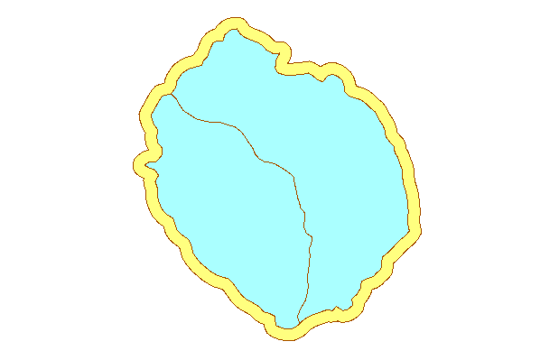
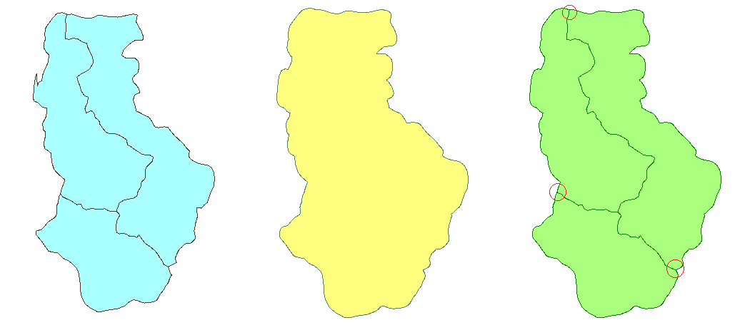
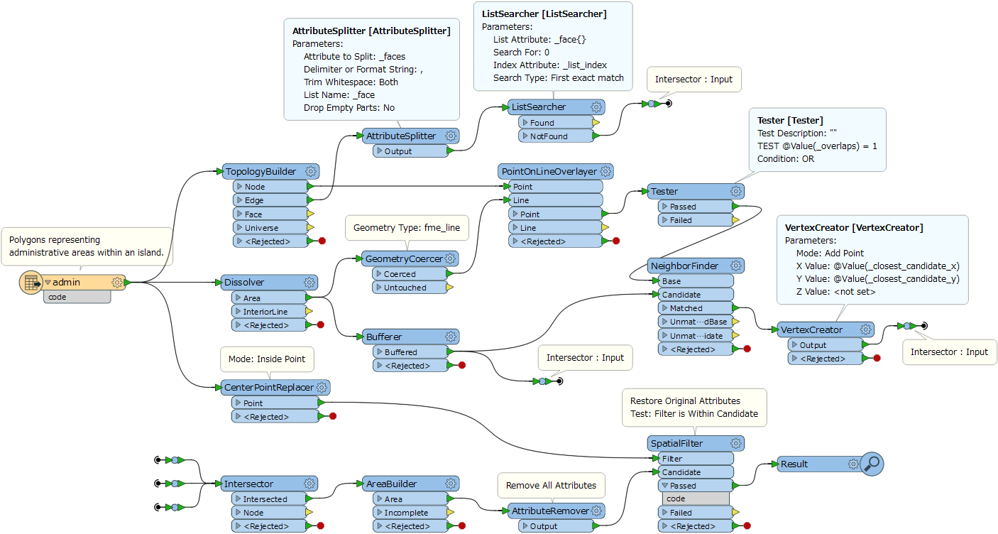
Hi I am trying to add a 30m buffer around the coastline. See the attached file. Unfortunately with the buffer tool I am not getting the results I want. It buffers all the polygons so I get overlaps between polygons. I've tried a few things but not getting the right results ie. area on area but this is not working for me as all I get is all the overlapping bits

9 replies

takashi
Influencer
  • April 6, 2017
Cannot find the file. Please post again.


gisgeek
Contributor
Forum|alt.badge.img+9
  • Author
  • Contributor
  • April 6, 2017

buffer.png attached is a sample area of what I am trying to buffer


takashi
Influencer
  • April 6, 2017

Sorry, the resolution of your image is low, cannot see what's wrong and/or what's right...

Do you need to make a donut area surrounding the input polygons, like this yellow area surrounding the light blue polygons?


gisgeek
Contributor
Forum|alt.badge.img+9
  • Author
  • Contributor
  • April 6, 2017

capture.jpg Hi Takashi I've almost got it but need to figure out how to get rid of the end cap holes


takashi
Influencer
  • April 6, 2017

If you need to create the yellow area containing the light blue polygons shown in my screenshot, consider using the Dissolver to combine the buffer areas into a single polygon.


gisgeek
Contributor
Forum|alt.badge.img+9
  • Author
  • Contributor
  • April 6, 2017
takashi wrote:

Sorry, the resolution of your image is low, cannot see what's wrong and/or what's right...

Do you need to make a donut area surrounding the input polygons, like this yellow area surrounding the light blue polygons?

So what I am trying to do is add the yellow boundary as an extension of the blue polygon ie. the buffer distance I am trying to add to the coastline.


gio
Contributor
Forum|alt.badge.img+15
  • Contributor
  • April 6, 2017

why not buffer all (or dissolve all and then buffer) and then clip the dissolved buffer with the objects you used buffer on??


sigtill
Supporter
Forum|alt.badge.img+24
  • Supporter
  • April 7, 2017

takashi
Influencer
  • April 15, 2017

If you need to create multiple buffer areas (right) corresponding to each original polygon (left) rather than a single merged buffer area (middle), you will have to define how the new boundaries on the expanded areas should be created.

For example, if the boundary can be defined as a straight line connecting between the end point of the boundary of the original polygons and the closest point on the outer boundary of the merged buffer, this workflow does the trick: buffer-coastline.fmwt (FME 2017.0)


Cookie policy

We use cookies to enhance and personalize your experience. If you accept you agree to our full cookie policy. Learn more about our cookies.

 
Cookie settings