
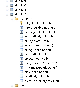
Hello, I have a BLOB field, it is supposedly multiple points that form a polyline, but I cannot export the blob into a usable geometry. I have tried GeometryReplacer and GeometryExtractor but I have not been able to get usable results. I attached an excel file with the BLOBs

Solved
Blob field in SQL Server to usable Geometry
Best answer by david_r
The only way I was able to get the GeometryReplacer to return anything else than an error was by first removing the "0x" prefix and treat it like a QlikMaps Encoded Polyline. However the result doesn't make much sense (to me):
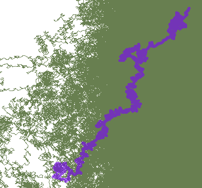
I think the key here is to know how the geometry is encoded in the blob, or at the very least know which software is used to manipulate it.


Reply
Rich Text Editor, editor1
Editor toolbars
Press ALT 0 for help
Helpful Members This Week


Enter your E-mail address. We'll send you an e-mail with instructions to reset your password.