
How to get to the bottom of this error message?

An error occurred while attempting to create an Esri Spatial Reference from an OGC Definition for the feature feature class 'wildlife_key_areas'. The error number from ArcObjects is: '-2147024809'. The error message from ArcObjects is: {The specified WKID (factory code) or WKT (definition string) is not a Projected Coordinate System.}

GEODATABASE_SDE writer: An error has occurred. Check the logfile above for details

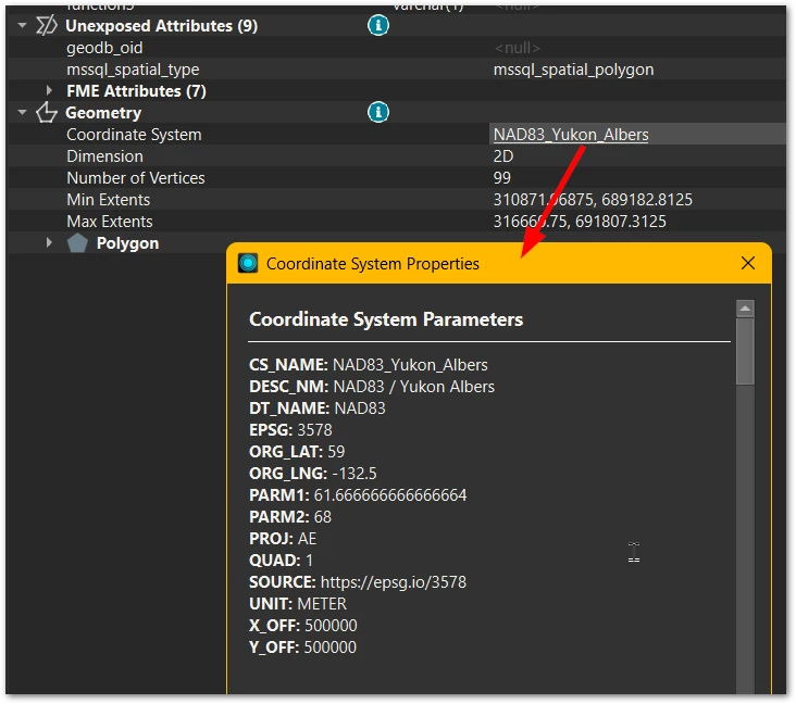
The Feature Information inspector on the incoming data stream says the item has a coordinate system and is happy to display it. The OGC WKT from that dialog is:

PROJCS["NAD83 / Yukon Albers",
GEOGCS["NAD83",
DATUM["North_American_Datum_1983",
SPHEROID["GRS 1980",6378137,298.257222101,
AUTHORITY["EPSG","7019"]],
AUTHORITY["EPSG","6269"]],
PRIMEM["Greenwich",0,
AUTHORITY["EPSG","8901"]],
UNIT["degree",0.0174532925199433,
AUTHORITY["EPSG","9122"]],
AUTHORITY["EPSG","4269"]],
PROJECTION["Albers_Conic_Equal_Area"],
PARAMETER["latitude_of_center",59],
PARAMETER["longitude_of_center",-132.5],
PARAMETER["standard_parallel_1",61.6666666666667],
PARAMETER["standard_parallel_2",68],
PARAMETER["false_easting",500000],
PARAMETER["false_northing",500000],
UNIT["metre",1,
AUTHORITY["EPSG","9001"]],
AXIS["Easting",EAST],
AXIS["Northing",NORTH],
AUTHORITY["EPSG","3578"]]


Hi ​@mattwilkie,

Are you using a custom coordinate system? One instance where I’ve seen this error was with a custom coordinate system created through the Safe's online tool: http://fme.ly/coordsys.

If you're using a custom coordinate system, please ensure that the Esri WKT pasted into Safe’s online tool is all on a single line, with no carriage returns. If you are copying it from epsg.io, use Copy Text, not the Copy Formatted, to copy the definition.

Let me know if this helps or if you need more information. I'm happy to help!


Hi ​@crystalwang , yes I’m using a custom coordsys created with the fme online tool. I copied the WKT from https://epsg.io/3578.wkt. Result attached.


I found it ​@crystalwang !  Thanks to your clue to distrust the output from the online tool I took a closer look at the files. Changing the word ESRI to OGC in the excpetions .db was the cure.

Broken:

# NAD83_Yukon_Albers
EPSG|NAD83_Yukon_Albers|3578
# NAD83_Yukon_Albers
ESRI|NAD83_...

Fixed:

# NAD83_Yukon_Albers
EPSG|NAD83_Yukon_Albers|3578
# NAD83_Yukon_Albers
OGC|NAD83_...


(Fun fact discovered while attempting to diagnose this: inserting a blank line into `C:\FME\coordsys.db` will cause FME to crash silently and completely when attempts to browse coordinate systems (Tools >> Browse Coordinate Systems). On the other hand attempting to disable a line by inserting leading `#` simply renames the coordsys “#cs-name”. Methinks there’s a bit of work to do checking for clean in- and output in the coordinate systems chain!)

I’m glad you were able to find the issue!

Thanks for sharing the solution as well as your observations with the coordsys.db file. I’ll pass this information to my team and perhaps we can provide more information in our documentation on common formatting issues with custom coordinate systems.