Hello FME brains trust. I have a situation where I need to run a regular update that takes a supplied point and looks up a corresponding lot and plan (cadastre) and add it as an attribute to the point. I am currently using the Point on Area overlay transformer, which works, but the updates are only one or two points, and our parcels layer has over 3 million features, which takes quite a bit of time to read and run.
I am hoping that there might be an alternative that basically runs a spatial query on the server side and only brings in the intersecting parcels or any other options that might help me streamline this process.
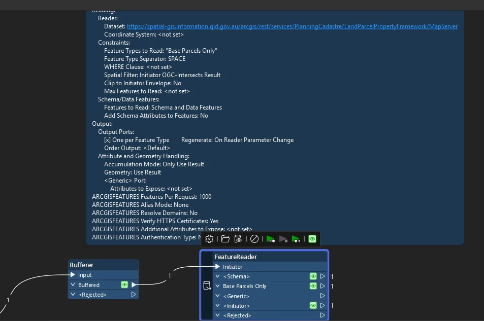
It looks like The input feature required is an area (I also just tried with a point). If you put in a Bufferer you can buffer the point(s) - this works.
I used Initiator Intersects Result.
Probably you still want to use the PointOnAreaOverlayer with the original point in the case the buffered point intersects more than one polygon.
This post is closed to further activity.
It may be an old question, an answered question, an implemented idea, or a notification-only post.
Please check post dates before relying on any information in a question or answer.
For follow-up or related questions, please post a new question or idea.
If there is a genuine update to be made, please contact us and request that the post is reopened.
I agree that performing spatial query on the server side would be the best solution if possible. An easy way to perform spatial query is to use the Spatial Filter paremter in FeatureReader.
However, it depends on the format of the source dataset whether spatial query is available. What is the format of the parcels layer?
It looks like The input feature required is an area (I also just tried with a point). If you put in a Bufferer you can buffer the point(s) - this works.
I used Initiator Intersects Result.
Probably you still want to use the PointOnAreaOverlayer with the original point in the case the buffered point intersects more than one polygon.
When I’ve used a point in the past as a spatial filter for a feature reader, the point automatically gets turned into a bounding box in the request
The query above also includes a spatial filter with input geometry '590425.077100,166764.367000,590425.077100,166764.367000', geometry type 'esriGeometryEnvelope', spatial relationship '-', and distance of '-' '-'
The advantage of the api call is you can choose not to return the geometry, just the attributes
Incidentally, I’ve never been able to get the api call to work with a geometry type of point either