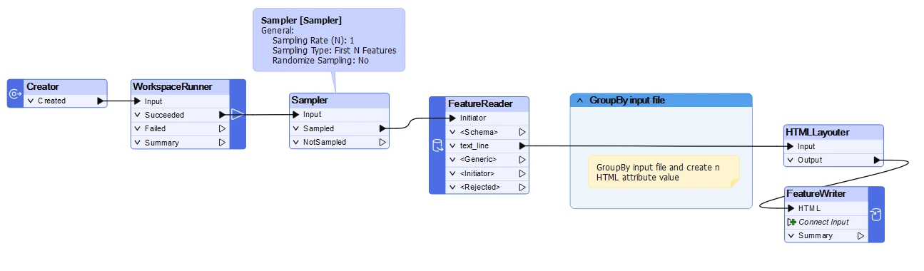
I have a workspace runner that runs a process to do a rough geo-referencing of multiple CAD drawings using a base polygon layer where each polygon matches each drawing.
At the end of each drawing, I want to create a simple report with a bunch of attributes and a map / image of the CAD drawing overlayed on my reference polygon to visually see how close it is.
I have hundreds of these drawings and don’t want hundreds of reports / images. Is it possible to append a page to a PDF or HTML report after each iteration of the process?