Question

add suburb attribute to roadname point using suburbs polygons shp

  • March 12, 2019
  • 3 replies
  • 26 views

I have a point file with road names but no suburb and I have a suburbs polygon shp how do I populate a suburb field in the roadnames shp from the suburbs shp ?

This post is closed to further activity.
It may be an old question, an answered question, an implemented idea, or a notification-only post.
Please check post dates before relying on any information in a question or answer.
For follow-up or related questions, please post a new question or idea.
If there is a genuine update to be made, please contact us and request that the post is reopened.

3 replies

chrisatsafe
Contributor
Forum|alt.badge.img+2
  • Contributor
  • 606 replies
  • March 12, 2019

Hi @nzg00ner57,


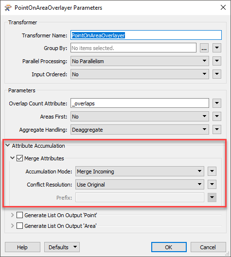
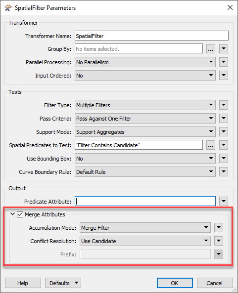
The PointOnAreaOverlayer will likely be your friend but you can also use something like the SpatialFilter (using the spatial predicate "Filter Contains Candidate" where the point dataset is the candidate).


Either transformer will work as long as you have the Merge Attributes parameter selected:

PointonAreaOverlayer:

SpatialFilter:

example.fmw


  • Author
  • 1 reply
  • March 13, 2019

Hi, Thanks for answering so quickly. Unfortunately I have workbench 2017 and it says the workspace example is newer. I am also a complete noob and can't seem to get the suburbs values to merge it only gives me a count number ie 1. Also no merge attributes tick box. Thanks


arnovananrooij
Contributor
Forum|alt.badge.img+5
  • Contributor
  • 73 replies
  • March 14, 2019

Hi, Thanks for answering so quickly. Unfortunately I have workbench 2017 and it says the workspace example is newer. I am also a complete noob and can't seem to get the suburbs values to merge it only gives me a count number ie 1. Also no merge attributes tick box. Thanks

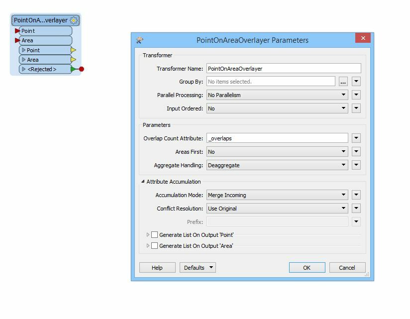
PointOnAreaOverlayer should work the way you configured it, because in FME 2017 attributes are merged by default. There is no chebox to merge the attributes. So your Point output port should contain all the point with the point attributes and when a point is inside an area also the attrubutes of the area.