Can anyone tell me how to colour the values of height data supplied by the Ordnance Survey in the Terrain 50 data in ASC format.
I want to create a gradual increase in colour dependant on the height value in the ASC file.
Thanks
Andy
This post is closed to further activity.
It may be an old question, an answered question, an implemented idea, or a notification-only post.
Please check post dates before relying on any information in a question or answer.
For follow-up or related questions, please post a new question or idea.
If there is a genuine update to be made, please contact us and request that the post is reopened.
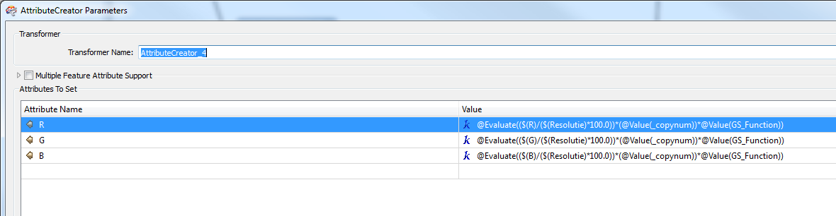
Depening on speed of colour increase u can use linear, cubic etc. algorithms.
U also need to normalize them ( for instance fme_c0lor is between 0 and 1 float)
Here is an example:
The GS_Function attribute holds the output for a algorithm. I create a couple algorithms and put them in a userchoicelist. R,G,B are also parameter, so u can use the wheel to choose a startingcolor.
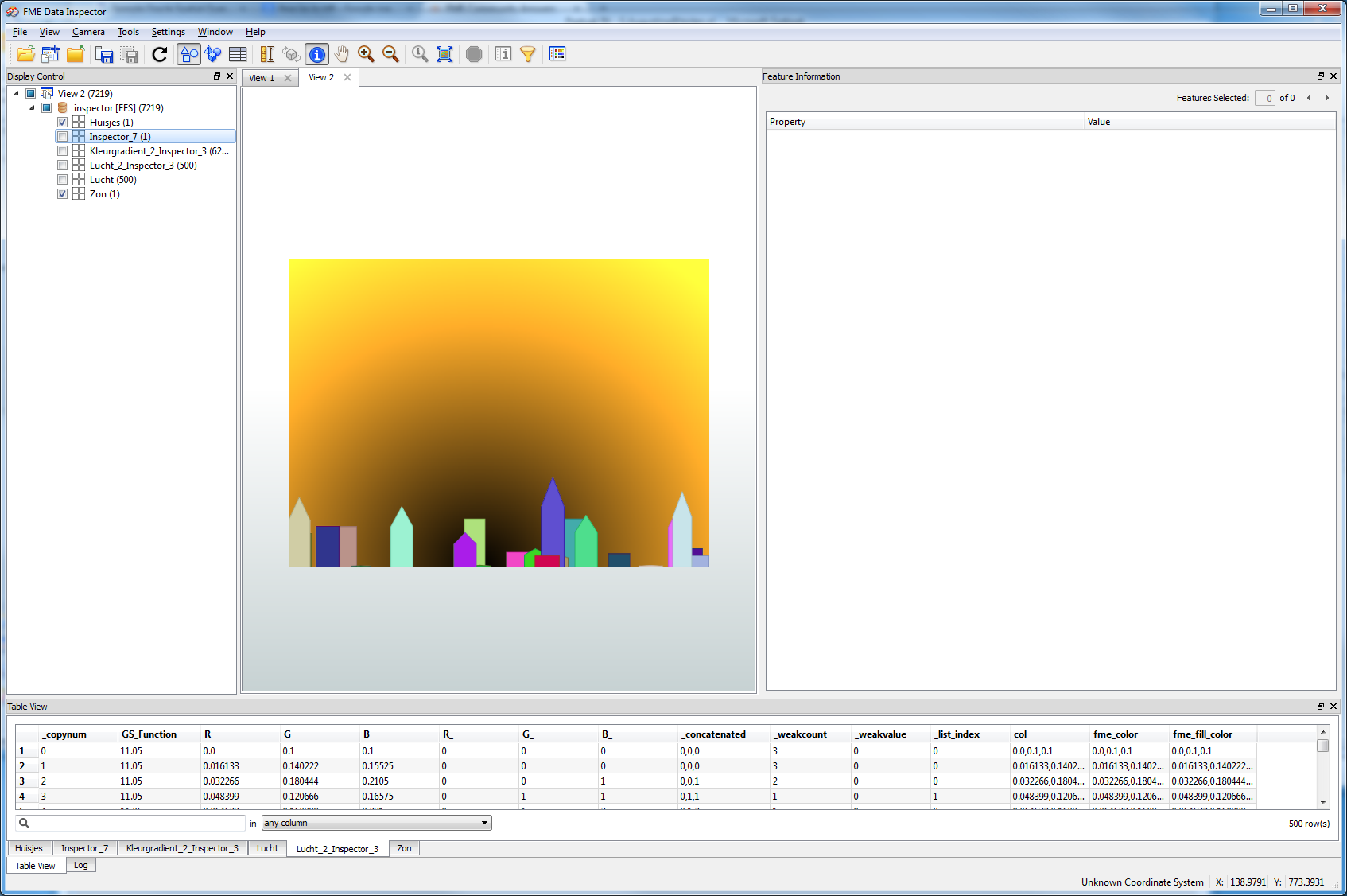
I use a RasterBandInterpretationCoercer to coerce it to UNIT8, scaling by by data values, use the AttributeCreator to create a palette and then The RasterPaletteAdder to add the palette to the raster, then the RasterPaletteResolver to turn it into an RGB raster
The palette i use for elevation is below. The zero value entry is a special case I use for NoData


 +10
+10