@Samuel Engström Some time ago I created a workaround for this situations.
I started from the asumptions that the mesh was a whole at first and it was tiled for eficiency purpose. We need to recreate the bounds of the original tiles so we can use the bounds to georeference the appearance rasters. Data inspector gave me this ideea when it first loads the meshes in 3D.
We use SurfaceFootprintReplacer to get the footprint of each mesh, Dissolver to dissolve the areas into one, BoundingBoxReplacer to get the original (untiled mesh) extents.
We use Tiler set to Tile Size 250x250 (I did statistics on the footprints to get a max area and figured out it should be 250x250 and selected Lower Left as Starting Corner because that fits the original meshes - so, I basicly winged it).
Use BoundsExtractor to get the original tiles bounds (folowed by Bufferer with a small value to trick SpatialRelator - not absolutely necesary but it gets rid of a lot of headeaches). This will be sent to the Requestor port of SpatialRelator.
In paralel use GeometryExtractor to put the geometries of the original meshes in an attribute folowed by SurfaceFootprintReplacer so we can use them in SpatialRelator. This will be sent to the Supplier port of SpatialRelator.
With the ports on SpatialRelator bussy we set it to Requestor Contains Supplier and send the Output port to GeometryReplacer with GeometrySource set to the _geometry attribute from GeometryExtractor.
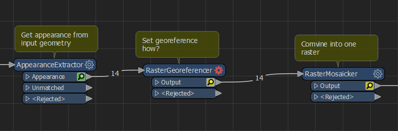
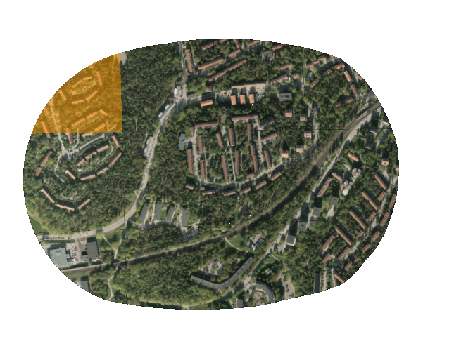
Now we can use AppearanceExtractor and the RasterGeoreferencer set to x/y min/max obtained from the correct tiles.
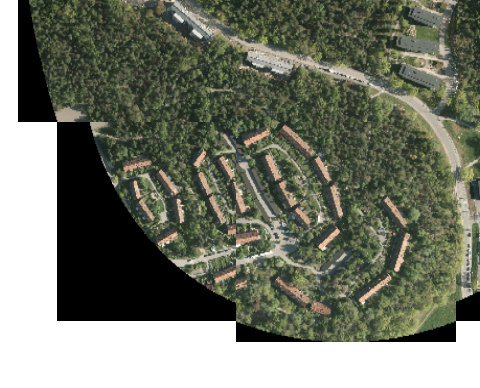
To join them just use RasterMosaicker if you need to.
I have attached a sample workspace made from your sample data using my home licence (I left the office a couple of hours ago and your case looked very intersting and very familiar) that made it all posible. So, in the end, thanks to Safe for making it all posible 😊

 Any help would be appreciated, thanks.


 Do you know if you can extract geolocation information from the appearance?