
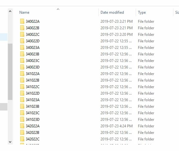
Hi! I have 3500+ 1:1000 topographic CAD files/tiles, each with thousands of features that I want to, ultimately, convert to shapefile and merge the tiles into 10*10 grid/mask that to reduce the number of folders.

Here is what I have attempted so far:

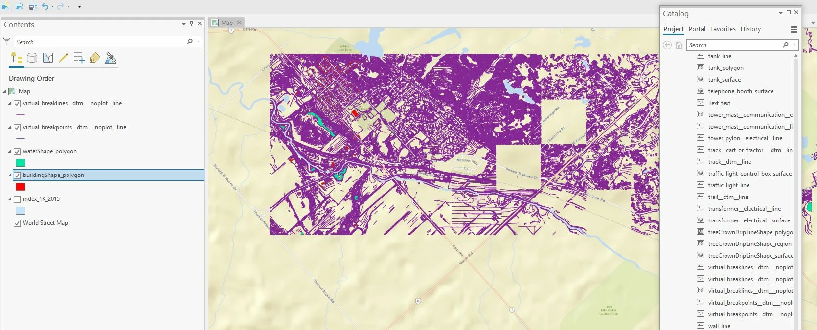
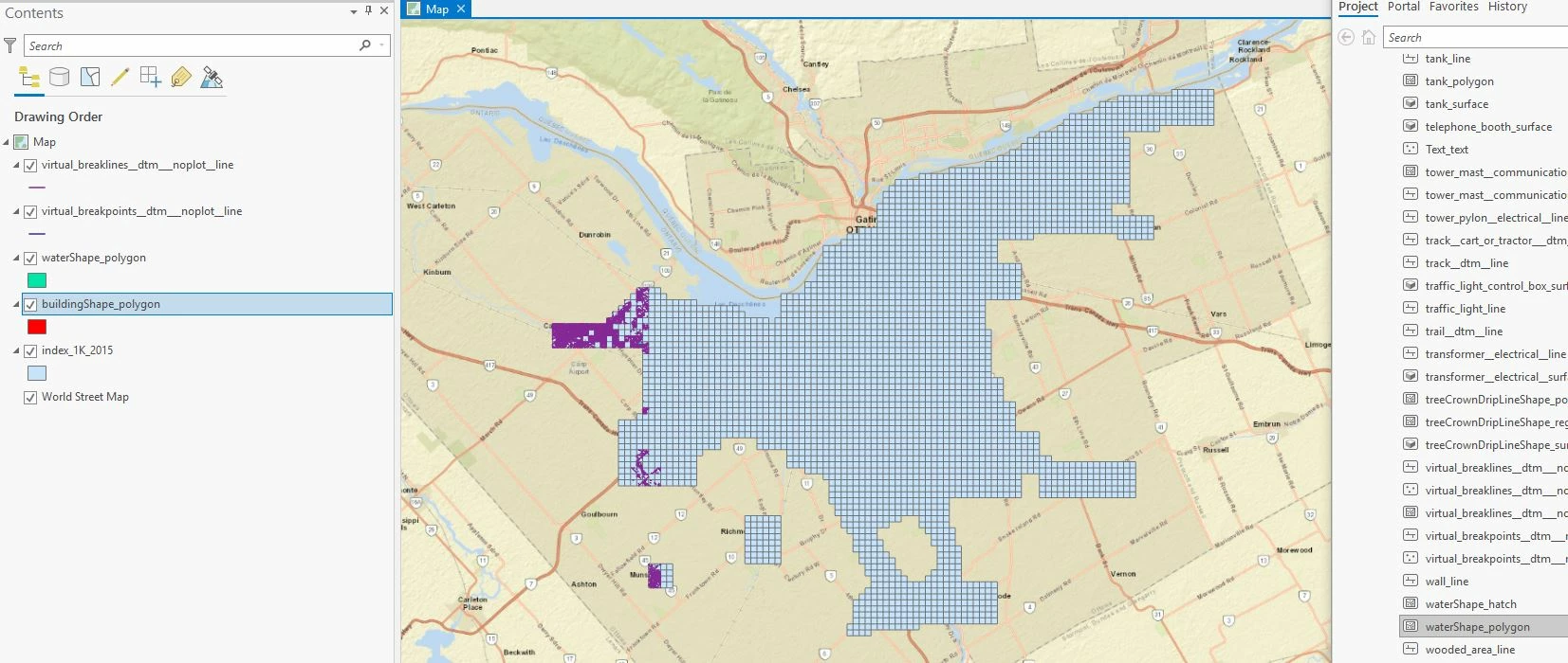
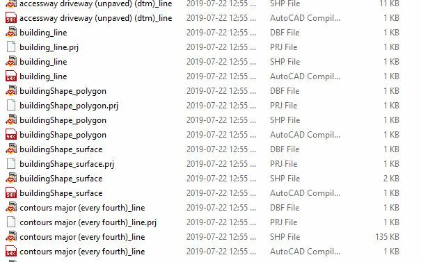
1. Convert CAD tiles into shapefiles (I accomplished this, see pictures below)


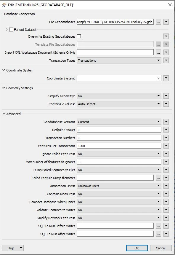
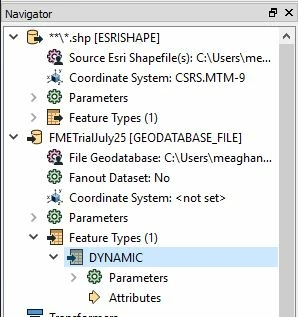
2. I have attempted to bulk load the folders (mulitple folder selction) into FME to convert to a File Geodatabase so that I can easily work with the large dataset in ArcGIS Pro

- I'm missing something as the conversion is not working completely, only part of the dataset is getting converted

3. I attempted converting the CAD tiles to Geodatabase and it failed.

4. I've attempted both of all of these in QuickTranslator and in Workbench

Maybe someone can offer up a good workflow (with pictures!) to convert 3500 CAD tiles with millions of features? I'm super new to FME and attempting to teach myself FME but I really want to accomplish this and cross it off my list!

I can offer more details and answer questions if needed!

Thanks in advance!

I would investigate steps 2 and 3 first to find out why it's not processing everything. Can you elaborate on that?

When you say only part of the dataset is being converted, does it look like entire CAD files are failing? If so, doublecheck whether they have the same layer structure as the ones that do process correctly.

@redgeographics Hi and thank you for following up with me. Yesterday I attempted a new trial of shapefile to geodatabase. The translation failed with an error log (see image Figure 1). Some of the features were converted and only to one area (see image Figure 2). The area that needs to be translated is identified by the CAD tile index seen in Figure 3. I'm new to building translations in FME so I may be missing a crucial click of a button. However, I think that the error may stem from the feature class "virtual_breakpoints__dtm___noplot__line." If that is the case, I will attempt to omit this feature in my build. I have attempted various builds, my latest one can be seen in Figures 4,5,6, and 7 (I tried dynamic schema but results were the same). I'm going to attempt some different trials today. First, I will split up my dataset and run the translation. Second, I will run the trial and remove that feature "virtual breakpoints" Any advice is welcome! Thank you!

Figture 1


Figure 2


Figure 3


Figure 4


Figure 5


Figure 6


Figure 7


I would investigate steps 2 and 3 first to find out why it's not processing everything. Can you elaborate on that?

When you say only part of the dataset is being converted, does it look like entire CAD files are failing? If so, doublecheck whether they have the same layer structure as the ones that do process correctly.

I realized I was supposed to add my reply here...please see my "answer" above 🙂 Thanks!


I realized I was supposed to add my reply here...please see my "answer" above 🙂 Thanks!

No worries, I have special powers ;)


@redgeographics Hi and thank you for following up with me. Yesterday I attempted a new trial of shapefile to geodatabase. The translation failed with an error log (see image Figure 1). Some of the features were converted and only to one area (see image Figure 2). The area that needs to be translated is identified by the CAD tile index seen in Figure 3. I'm new to building translations in FME so I may be missing a crucial click of a button. However, I think that the error may stem from the feature class "virtual_breakpoints__dtm___noplot__line." If that is the case, I will attempt to omit this feature in my build. I have attempted various builds, my latest one can be seen in Figures 4,5,6, and 7 (I tried dynamic schema but results were the same). I'm going to attempt some different trials today. First, I will split up my dataset and run the translation. Second, I will run the trial and remove that feature "virtual breakpoints" Any advice is welcome! Thank you!

Figture 1


Figure 2


Figure 3


Figure 4


Figure 5


Figure 6


Figure 7

I am not sure a dynamic translation is the best way to go here, you may want to try generating a workspace from Shape to GDB to get it set up automatically.

Yes, drop that offending feature type and see what happens. If it's working correctly you can retile the dataset according to your own specs using the Tiler transformer.


Reply