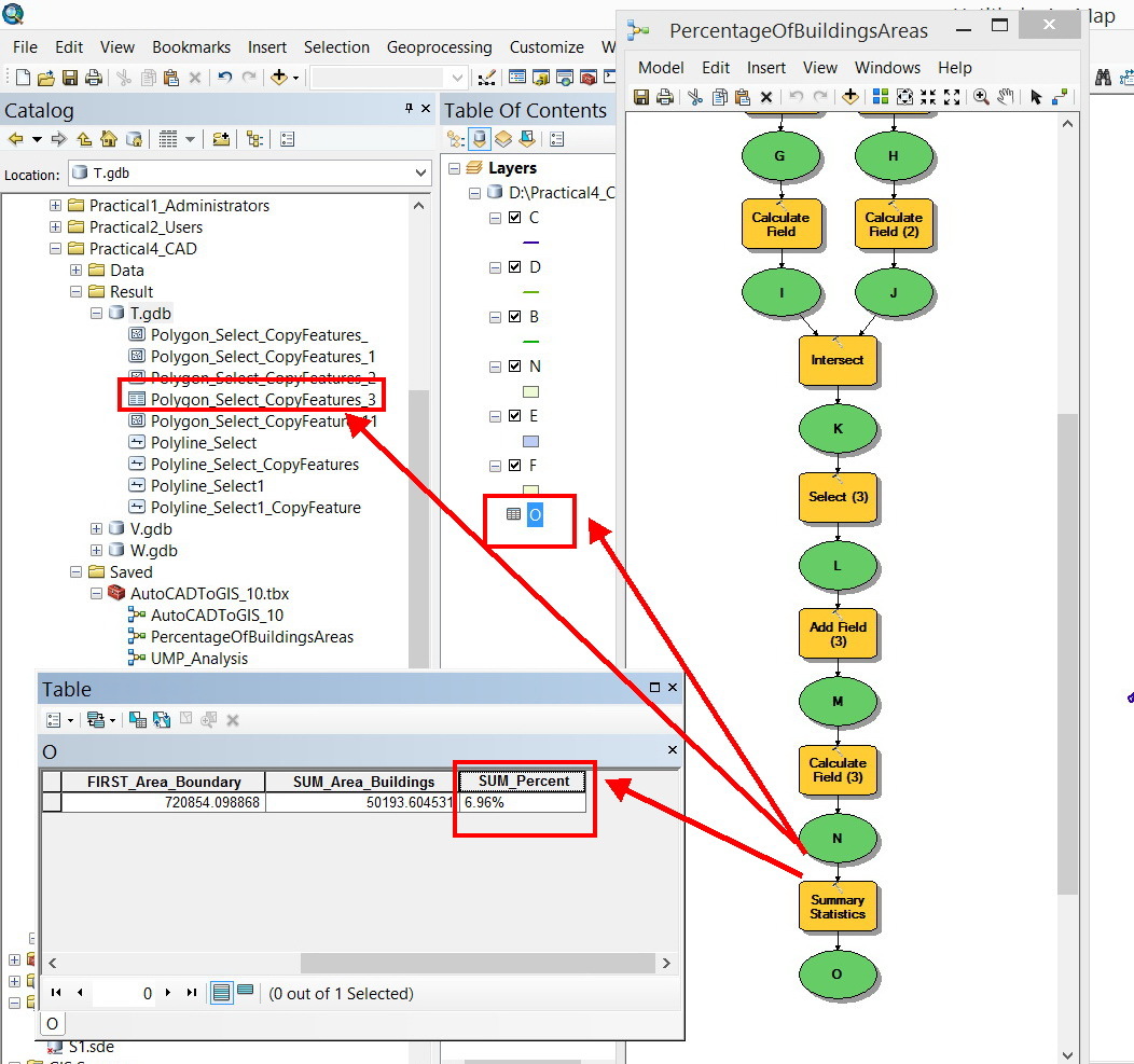
I wanted to sum up the values of all rows of a field in an attribute table but couldn’t figure out how to do this in FME.
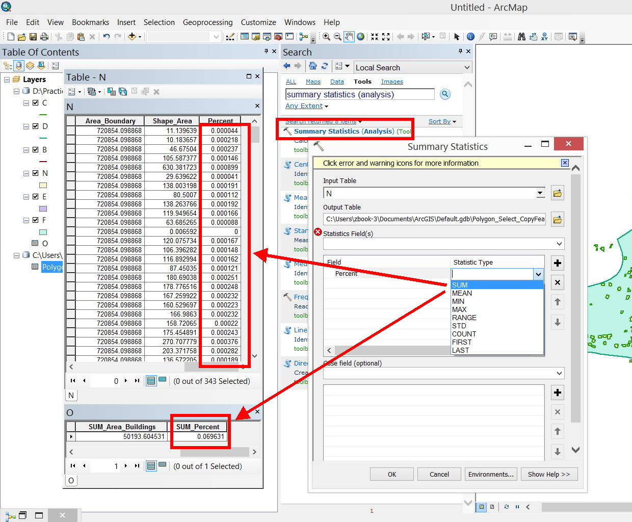
In ArcGIS, this can be done using the command “Summary Statistics”
Thank you
Best
Jamal


 +5
+5
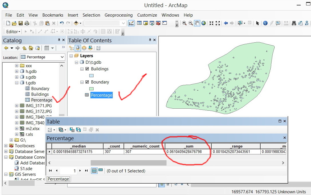
I wanted to sum up the values of all rows of a field in an attribute table but couldn’t figure out how to do this in FME.
In ArcGIS, this can be done using the command “Summary Statistics”
Thank you
Best
Jamal
Best answer by takashi
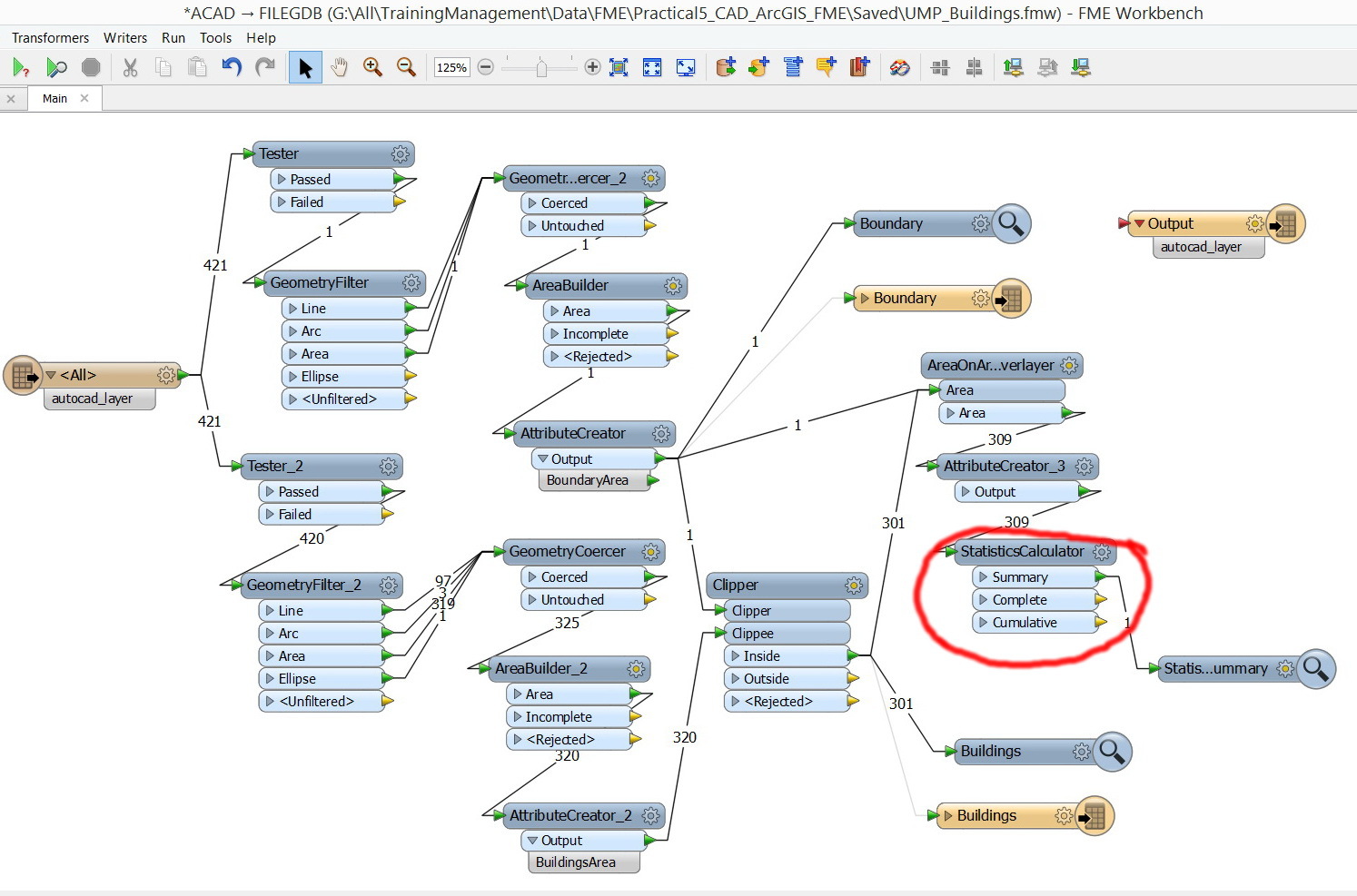
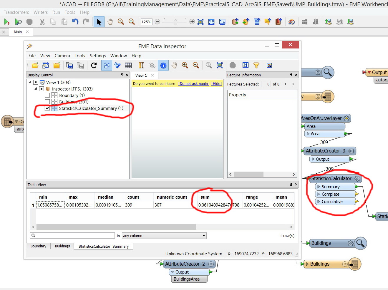
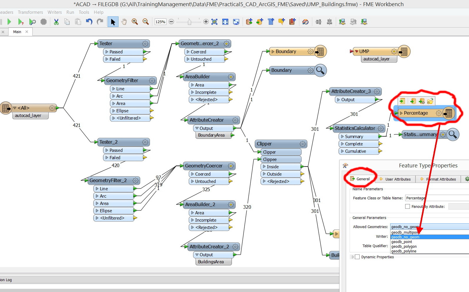
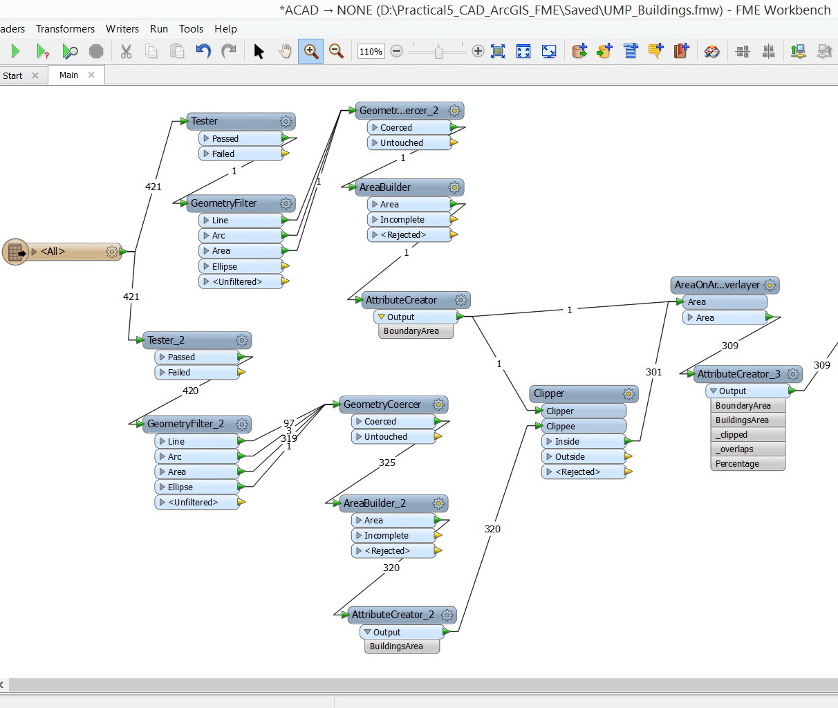
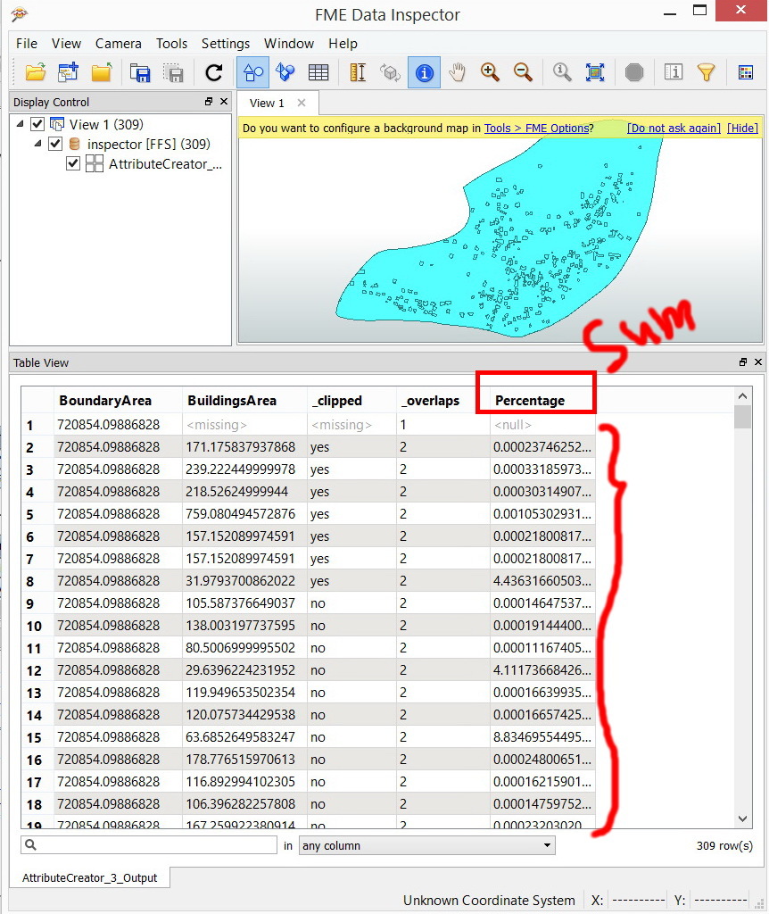
I think the Aggregator (using "Attributes to Sum" parameter) is convenient to calculate sum of attribute(s).
If you need to calculate some other fundamental statistics values simultaneously - e.g. min, max, median, mode, average, standard deviation etc., consider using the StatisticsCalculator.
Takashi