Hello everyone.
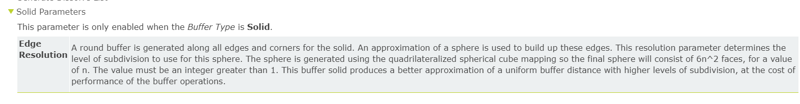
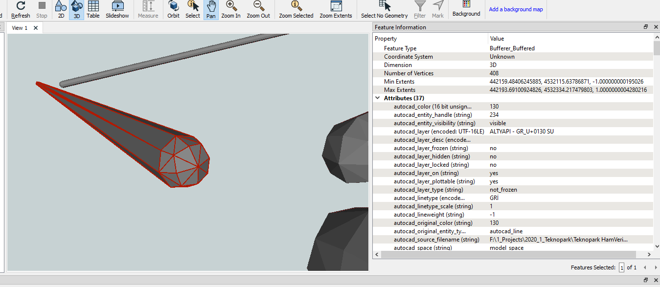
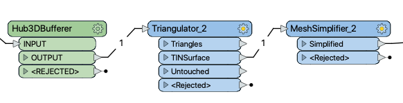
I have a .dwg file including substructure data of an area. I'm studying on creation a 3D city model with virtulacityPUBLISHER. To be able to create this, I'm transforming dwg file into a geojson file format via "bufferer" transformer (Buffer Type: Solid). But solid type creating a semi-sphere at the end of the line. And then, generating surfaces which consist of 6n^2 faces. If we think about an awful a lot details for all substructure details (e.g. gas or water tubes, cables etc.) it will be too much surfaces to publish (with a web browser interface) for a city model. So, how can i simplify the lines (especially end of the lines) which is using for creating goejson file types.
Thanks.