I need to use an FMW script to extract xyz files from a single netcdf file. When using the data inspector, I see that the netcdf has several variables and multiple bands of data for each variable. Ultimately I am desiring the u and v datasets. I feel like I am close with my FMW file, but somehow it is not extracting the u and v datasets correctly.
My steps thus far are as follows:
1. Open FTP directory: ftp://ftpprd.ncep.noaa.gov/pub/data/nccf/com/rtofs/prod/rtofs.YYYYMMDD/
(you need to adjust the date characters YYYYMMDD)
2. scroll to bottom and open the rtofs_glo_uv_YYYYMMDD_hcasts.nc.gz file
3. use gzip to uncompress the file: gzip -d rtofs_glo_uv_YYYYMMDD_hcasts.nc.gz
4. Open FME Workbench 2015 (I only have 2015 desktop)
5. Open FME script (attached here)
6. Provide input parameters:
SourceDataset = rtofs_glo_uv_YYYYMMDD_hcasts.nc (netcdf file that was downloaded above)
DestDataSet = C:\\
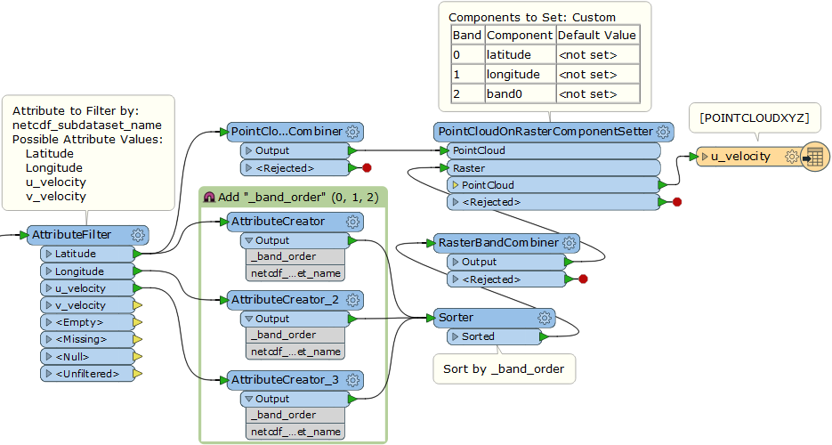
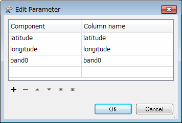
The expected output is to have a u_velocity and a v_velocity xyz file. Each file will have the following columns: lat, lon, band0
This is a very large dataset, so I use a clipper transformer to subset out the results - thus saving a lot of processing time. If there are better strategies to doing a subset, I am open to other ideas too.
Something about my script isnt properly traversing the netcdf structure properly to extract the lat, lon, u and v data. I appreciate any discussion or assistance with getting my script working.
Thanks,
Chris