

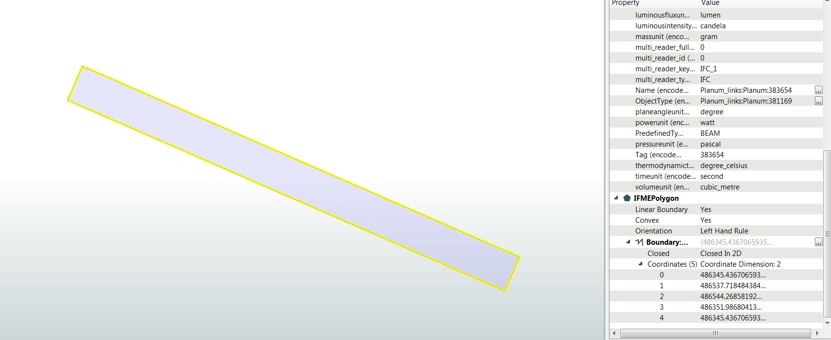
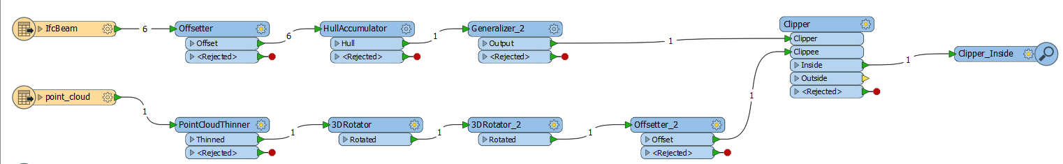
I get a Point Cloud from Multicopter Surveying (Photogrammetry), stored in E57 File. This Point Cloud should be clipped to an Area of Interest, stored in Revit Model. So I exported the Model with the Revit Exporter to '*.rvz' and IFC4. I read the Geometry from IfcBeam. After this I create the Hull of the Geometry (2D) and send it to the Clipper. When I inspect the geometry with the FME Inspector it looks correct.
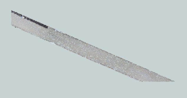
After the clip-operation the point cloud is cutted wrong on to the lower right corner.
I tested also the geometry extraction with SurfaceReplacer in combination with 2D Forcer, same problem... To test the correct position of the two parts I inspect it.
Workspace looks like this (rotater and offsetter beacuse there is a bad georeference):
Should I use other transformers for the Point Cloud clip-operation? Any ideas?
Thank you!


