
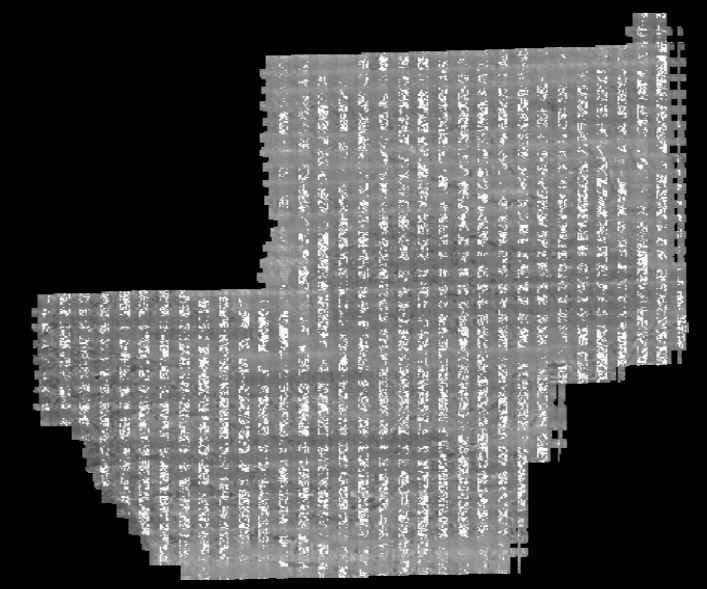
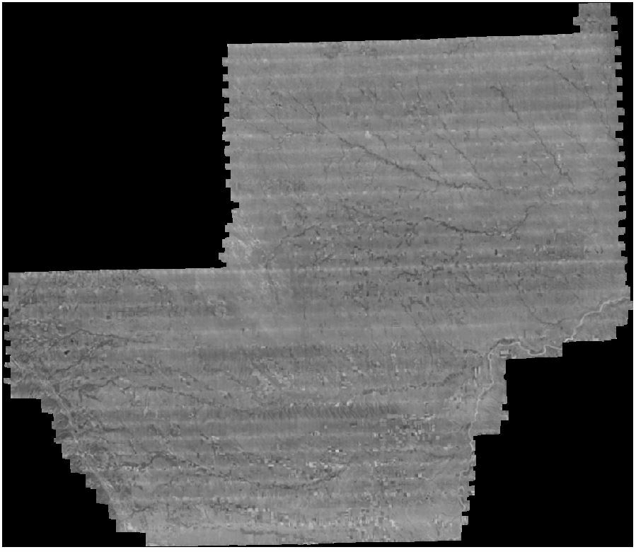
My workbench that reads/writes geotiffs worked great until I upgraded to 2019. I thought it was a writer issue, but it turns out it is an issue with the reader. The input geotiff is an ortho generated by Agisoft Metashape software. Viewing the geotiff in FME 2018 (or Arc or QGIS), it looks correct. Viewing in FME 2019, it looks very different with lots of banding and altered pixel values. I have attached 2 screenshots - 2018_good and 2019_bad to show the difference. This is the exact same file, yet FME 2019 reads it (and writes it) very differently. I have viewed geotiffs from other sources in FME 2019 and they read correctly, so there must be something different about these particular files from metashape.. but why does FME 2018 have no issue with them?
Test image -


")


