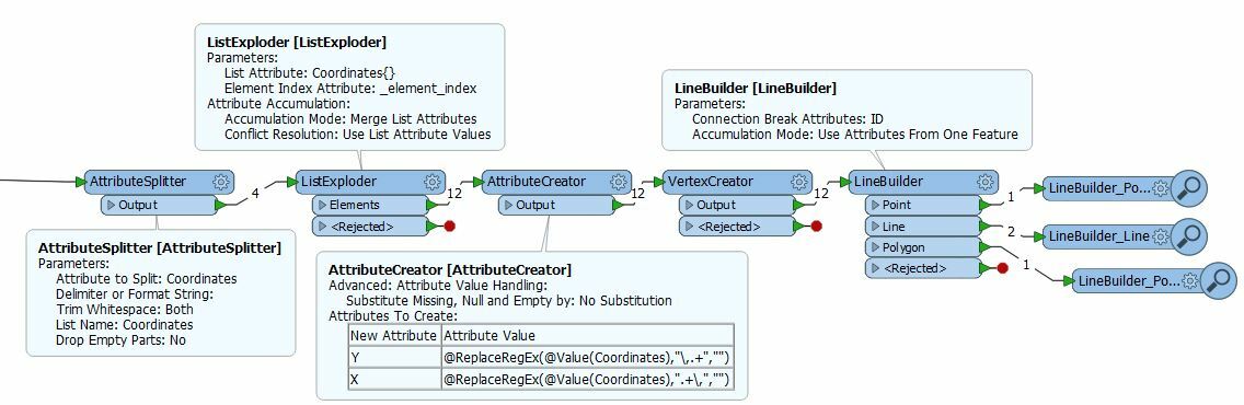
I have a CSV file with attributes in several columns and coordinate pair(s) in a single column.
The column with coordinate data has X and Y coordinates arranged like this:
Y, X, Y, X
430,495,678,272
Y, X Y, X Y, X Y, X
82265,5487539 82479,5487545 82553,5487896 82645,5486795
Coordinates may contain one or more coordinate pairs. There is an attribute within the file indicating the number of coordinates pairs the feature has but no attribute to indicate whether the feature is a point, line, or polygon.
What would be a way to create correct geometry from the list of coordinates?


")