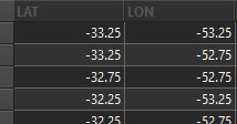
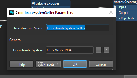
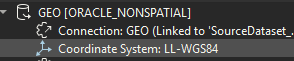
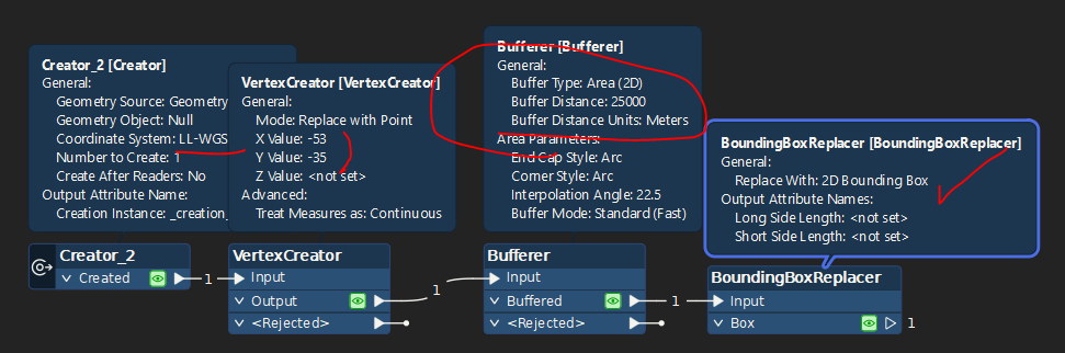
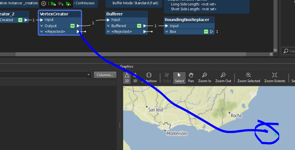
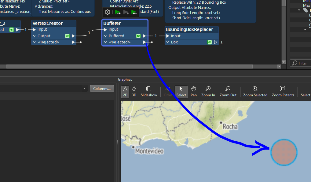
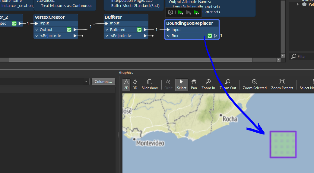
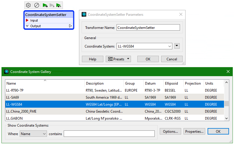
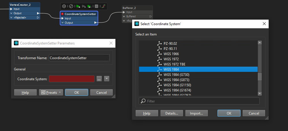
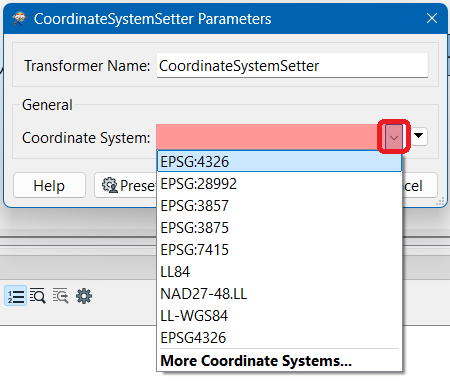
I have points created by vertex creator but my points don’t have coordinate system. I need create by points square buffers with 25 kilometers. I’m using coordinate system setter to define WGS84, after use bufferer but the error below is showed.
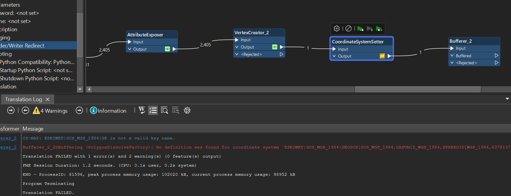
Bufferer can’t understand my coordinate system but without the coordinate system isn´t possible to generate the buffer.
Thank´s
Page 1 / 1
Hi @mr_fme If I read the error message correctly
I think you are looking at a metric system like UTM. Do you have an example of your x and y values that you are using in the vertex creator? Also is this a WKT file? Is there a mention of a coordinate system in the text file?
In de CoordinateSystemSetter you are not supposed to give the definition of the coordinate system, just the name. So something like EPSG:4326 in your case.
From what you show of your log, you’ve entered the entire definition in that text field…
@crutledge
@s.jager
In coordinate system setter, only this name is allowed.
In the reader is possible, but no work yet:
@crutledge
Okay. So not metric. Thanks for sharing. I tried something and it should work for you if you make sure to define settings. Also I think you might want to use the BoundingBoxReplacer if you want a Square.
VertexCircular BufferBounding Box
I hope that helps!
@crutledge
No, unfortunately!
You are using creator. I’m using oracle nonpatial, and create points by vertex creator. I can´t to put LL-WGS84 in coordinate system setter, only GCS_WGS_1984.
Are you sure about that?
yes
Well that is confusing. @mr_fme In the selector for Coordinate System can you filter for LL?
Also. That shouldn’t make a difference. Can you try 2 things? 1. Select WGS84 (if you cannot find the LL in the filter) and proces UP TO the CoordinateSystemSetter? Does it complete? 2. Can you open the Bufferer and share a picture of the settings? If you delete and re-add the bufferer does it still error out? Hopefully we can figure this out.
That is weird. That screenshot does not even look like the proper Coordinate System Selection selection dialog you should get. And in the Coordinate System: field, there should be an arrow pointing down, like this:
So I’m starting to think there may be something wrong with your FME installation.
If you use the Reprojector, what does that look like? It should have the same interface with a dropdown that lists coordinate systems, and I don’t think it should have the 3 dots like yours does. Also see Geomancer’s screenshots...
Which version are you using? And did it install correctly and fully, or did you customize something?
@s.jager Good eye! Yeah that is strange.
So,
Thank’s for yours attention in my discussion.
My problem was solved with simple way…
My problem was in Navigator → Reprojection Engine: ESRI to FME.