Question

Change Detector - I want to use to see if each polygon between datasets has changed.

  • September 28, 2019
  • 6 replies
  • 32 views

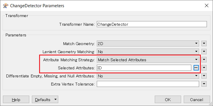
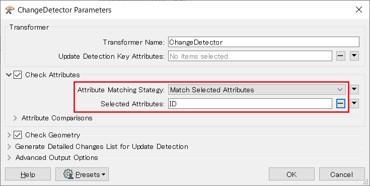
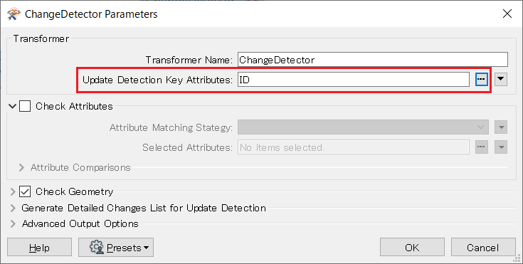
The datasets are updates and should have the same ID. I don't know how to ensure that the polygons are the same or different for the exact same ID. Is there a way to set the ID as the method of checking the polygon? I think I'm missing something simple.

6 replies

takashi
Influencer
  • September 28, 2019

Hi @planomax, the Matcher transformer might help you.

Set the ID attribute to the Selected Attributes parameter and configure the Check Geometry parameters appropriately. Then, the features that have changed will be output from the Matched port (two for each ID) and the SingleMatched port (one for each ID) and others will be output from the NotMatched port.


takashi
Influencer
  • September 28, 2019
takashi wrote:

Hi @planomax, the Matcher transformer might help you.

Set the ID attribute to the Selected Attributes parameter and configure the Check Geometry parameters appropriately. Then, the features that have changed will be output from the Matched port (two for each ID) and the SingleMatched port (one for each ID) and others will be output from the NotMatched port.

Alternatively the ChangeDetector could also work for you with the same settings I described above.


  • Author
  • September 28, 2019

Thanks for responding, but everything I checked I don't see what you are saying. Is there a example somewhere?


takashi
Influencer
  • September 29, 2019
planomax wrote:

Thanks for responding, but everything I checked I don't see what you are saying. Is there a example somewhere?

FME 2018.1

FME 2019

OR


  • Author
  • September 29, 2019

After some testing using some help given here, it appears that the FeatureReader I am using isn't outputting all the fields. I am trying to loop through 1000s of files.


One test I did was to create a simple workspace using a ESRI reader which exposed the attributes and I'm able to select.


But the ESRI reader doesn't appear to allow variable input.


I found another forum question that appears to have the same issue.


Is there a way to get the ESRI reader functionality with variable input?


Thanks for all help - trying my best to learn this product.


  • Author
  • October 3, 2019

Just to follow up - since the featureReader didn't show the attributes in the 'Attributes to Expose' I didn't realize I could just type them in. Not sure why they are not selectable. But now I have the workspace working. Thanks for all the responses. Great forum here!


Cookie policy

We use cookies to enhance and personalize your experience. If you accept you agree to our full cookie policy. Learn more about our cookies.

 
Cookie settings