Hello, this problem probably has a very simple solution but I'm struggling to come up with anything!
My input is a large number of CSV files where each CSV contains a list of coordinates that form a route.
Within each route, there are different travel modes which each need to be represented by a separate line. The travel mode for a segment within a route is identified by an attribute in the input CSV.
To create the lines, I am using a PointConnector transformer, using both the 'route ID' and 'travel mode' attributes as the Connection Break Attributes.
If we joined the the list of coordinates for a route all together, they would form a continuous line, but because we are breaking the routes up by travel mode, the output segments have gaps between them where their ends should meet.
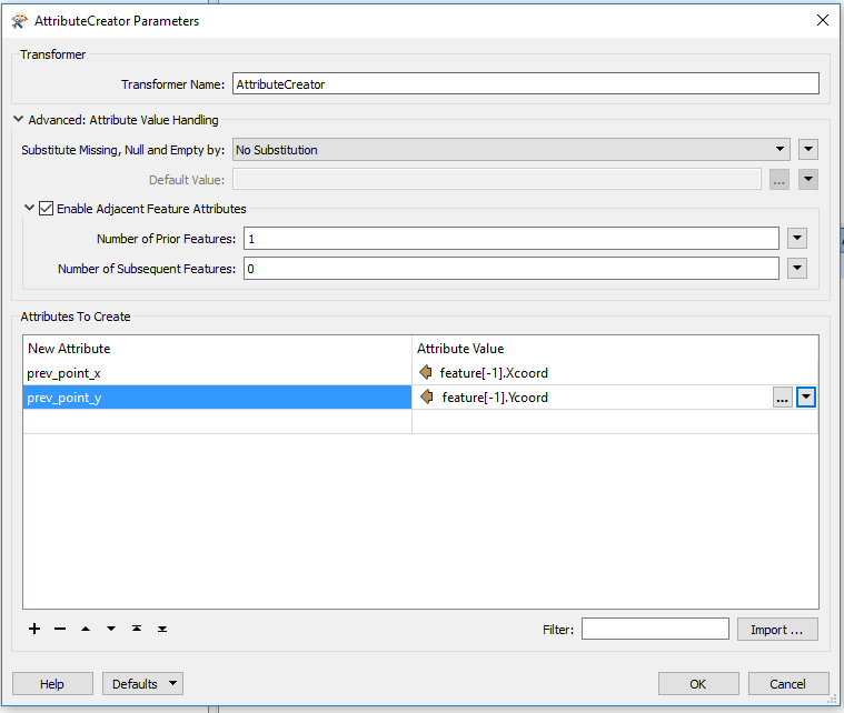
actual result:
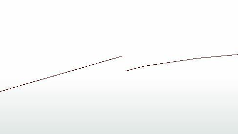
desired result:
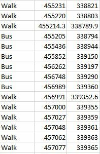
The gaps are occurring because the start coordinates of one travel mode segment, are also the end coordinates of the previous segment:
If anyone has ideas about how to fix this it'd be much appreciated. Have tried the snapper without much success. There are almost 2000 input files so it's not practical to manually duplicate rows in the data.