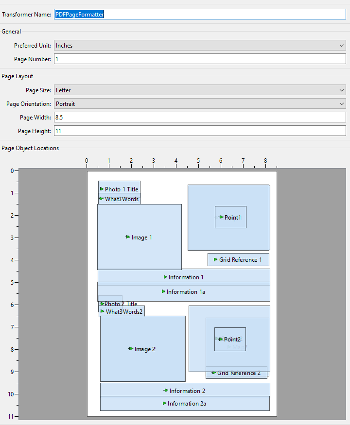
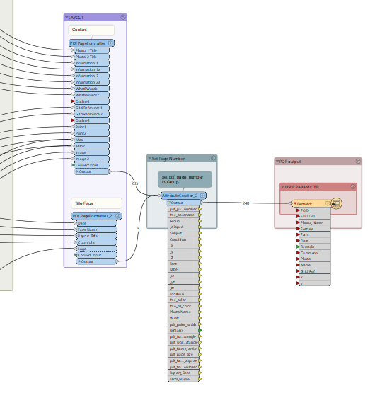
I'm buffering a points shapefile, then using the resulting square polygons to clip a raster (vrt OS backdrop). The clipped rasters are then passed to a PDF PageFormatter to produce location maps for each point. My problem is the raster outputs once written to PDF seem to move - placed in relation to the location of the point. how can I force the rasters to be drawn in the same place on the page everytime?

Question