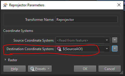
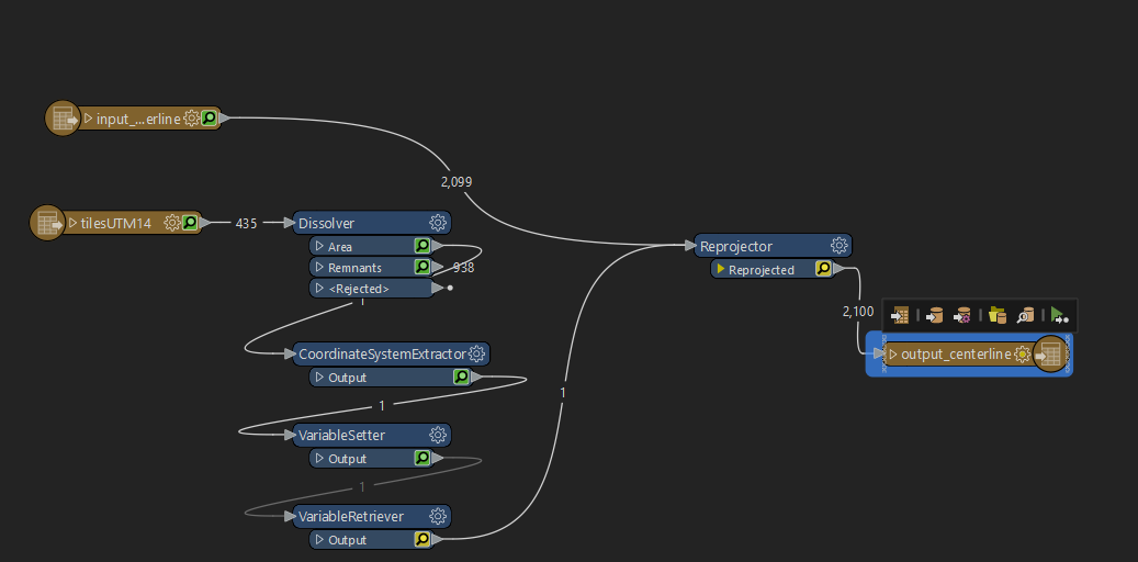
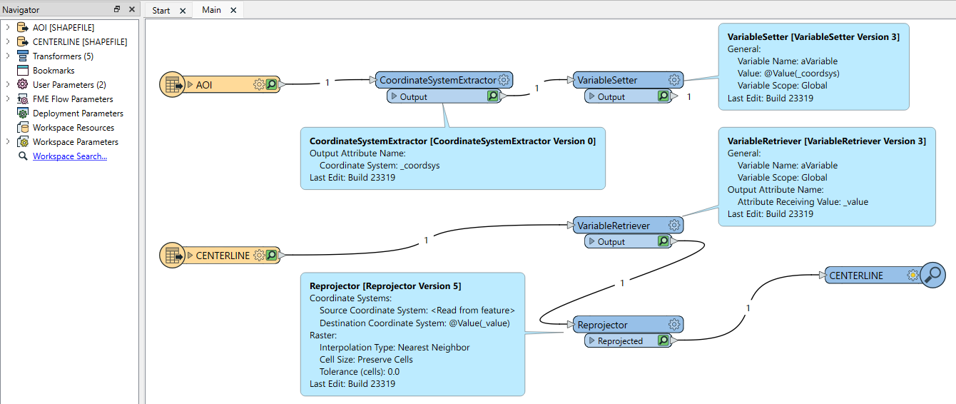
I have two readers reading two shapefiles: a centerline and a AOI of interest. The centerline is in WGS 1972 and the AOI. I need to reproject the centerline to the coordinate system of the AOI. Is there a way to define the "Destination Coordinate System" with that of the AOI?