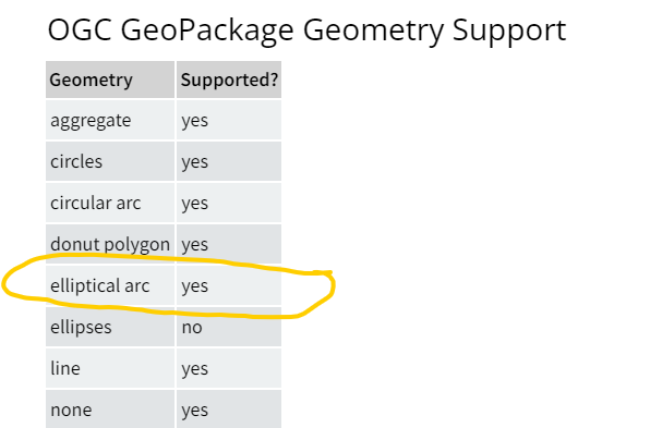
There are GML/FGDB dataset with "round conner polygon" or multilines geometry which is mixed "curve and lines". It can't be written into GPKG file.
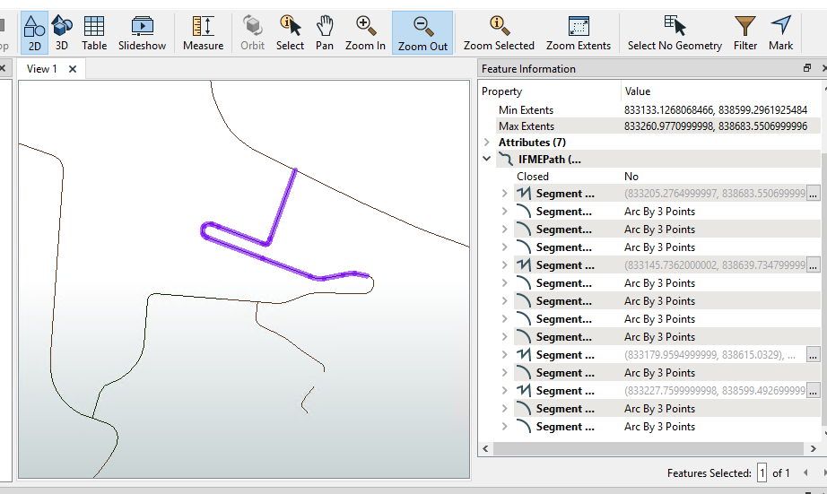
src dataset geometry
 The output geometry is IFMENull
How can fix it?


 +1
+1There are GML/FGDB dataset with "round conner polygon" or multilines geometry which is mixed "curve and lines". It can't be written into GPKG file.
src dataset geometry
The output geometry is IFMENull
How can fix it?
Best answer by david_r
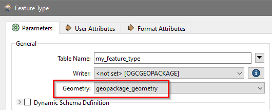
Did you try using a generic geometry column in the GeoPackage table? That should work.
Try this:


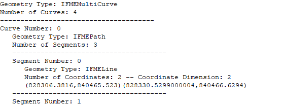 ...
...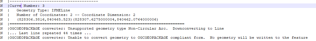 Our geometry Data is this
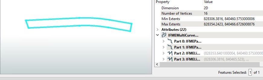 what's Non-Cirular Arc.