

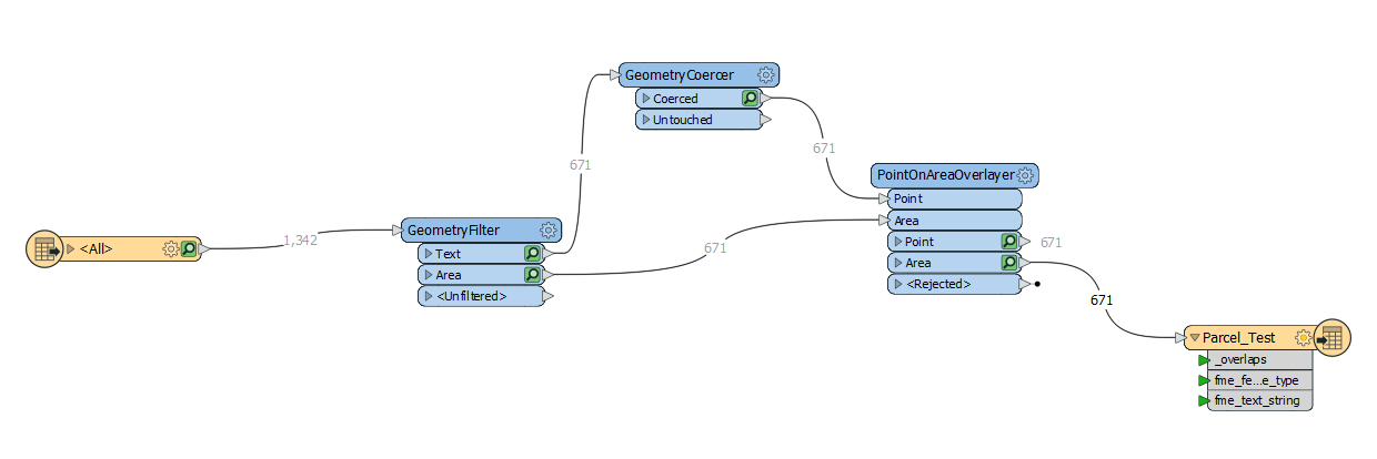
I'm totally new to FME and straight away having problems with conversion from DWG. The conversion is successful but when i zoomed in to the layer (in Arcgis Pro) the parcel data appears to be located somewhere in the middle of the ocean. The parcel data is in GDM2000 Malaysia RSO projection. I wanted it to be displayed in UTM WGS84 48N along with other GIS layers. I really couldn't find out what I am doing wrong here. Thanks.
https://drive.google.com/file/d/13GyjeDa9lyH3T4sOUnTKcs4j4ayADFkr/view?usp=sharing


