
Hello there
we need to generate a report for then many roads,
we need to draw a line between each point and show the distance value
The same as the image below
is there a way we could use FME in this case


 +11
+11Hello there
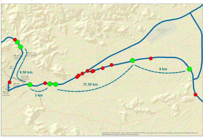
we need to generate a report for then many roads,
we need to draw a line between each point and show the distance value
The same as the image below
is there a way we could use FME in this case
Enter your E-mail address. We'll send you an e-mail with instructions to reset your password.


