Question

Error in clipper: “Invalid Clippee detected, using first coordinate of Clippee.”,


jamal
Forum|alt.badge.img+5
Error in clipper: “Invalid Clippee detected, using first coordinate of Clippee.”,


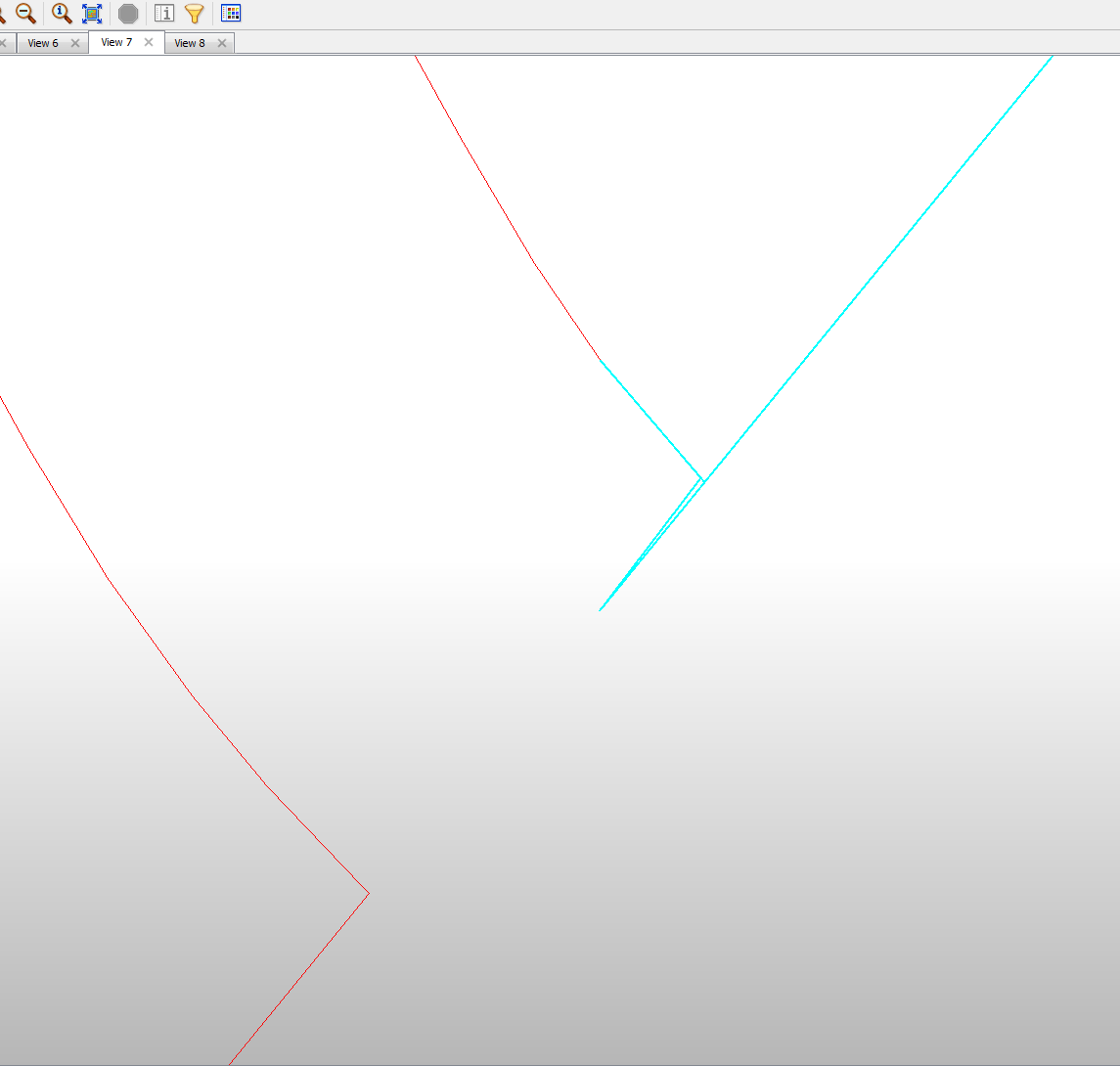
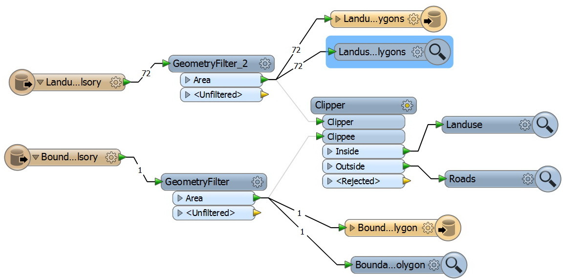
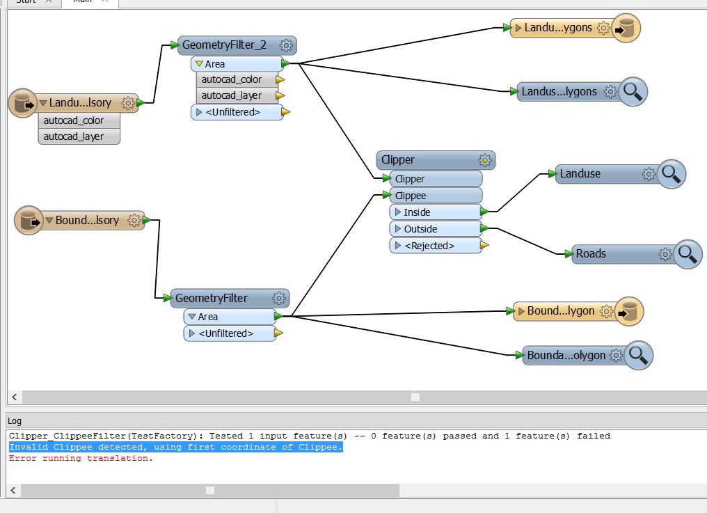
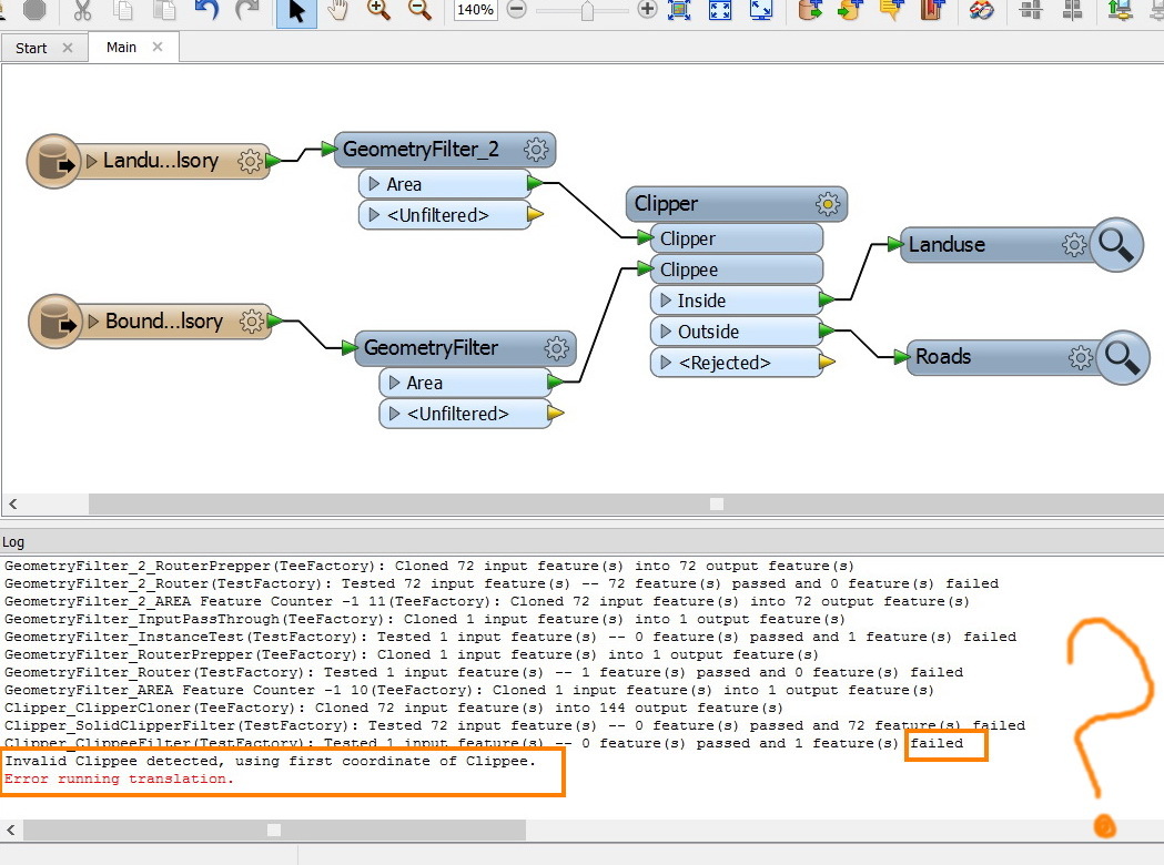
I wanted to apply the clipper between two hatches (areas) layer but I got the error below


“Invalid Clippee detected, using first coordinate of Clippee”


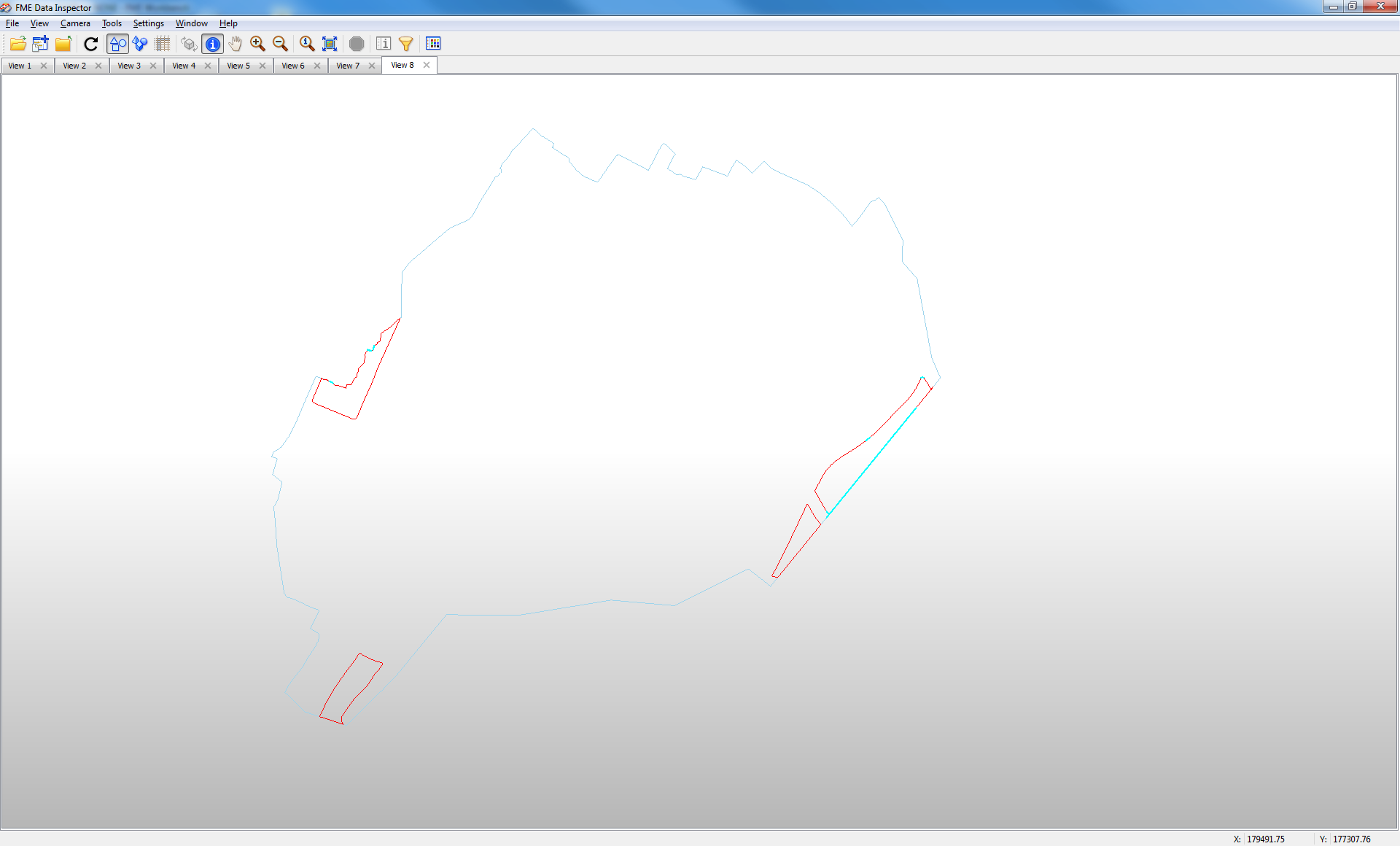
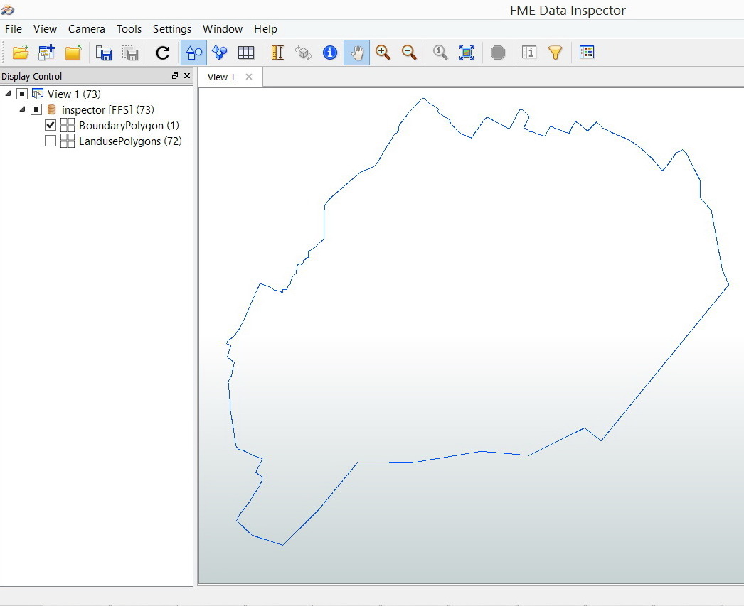
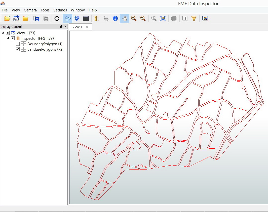
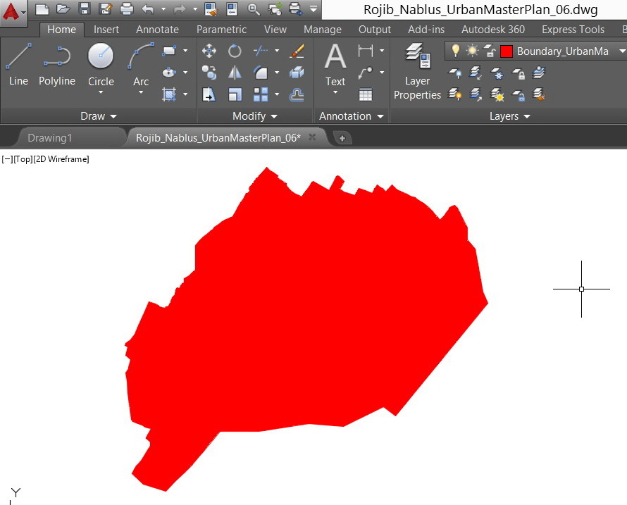
The first layer is: Boundary_UrbanMasterPlan_HatchType_Design_Compulsory


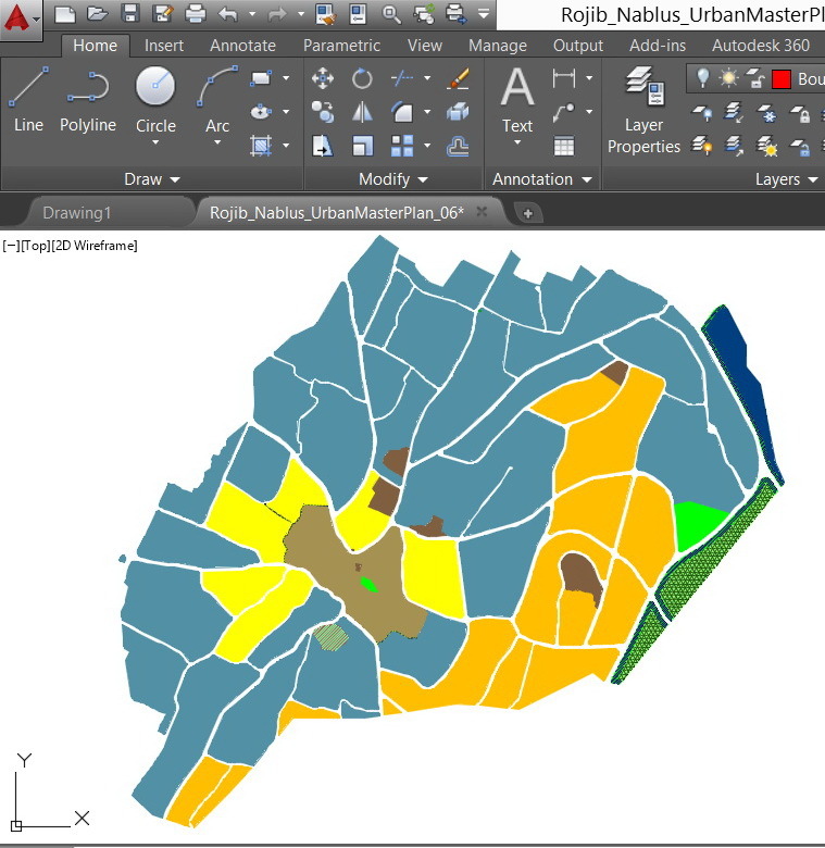
The second layer is: Landuse_UrbanMasterPlan_HatchType_Design_Compulsory


Mathematically,


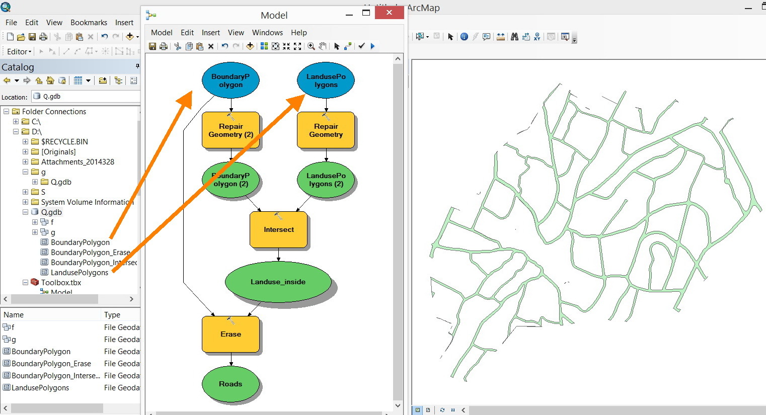
Roads = Boundary - Landuse


What might be the issue here?


Downloads:


CAD file:


http://www.mediafire.com/download/lf3y6k096nj1724/Rojib_Nablus_UrbanMasterPlan_06_X.dwg


Workbench file:


http://www.mediafire.com/view/ubkuygxusxpkuk8/Clipper.fmw


Thank you


Best


Jamal

5 replies

gio
Contributor
Forum|alt.badge.img+15
  • Contributor
  • March 27, 2014
Hi Jamal,


First of alll when i clip these in fme 2013 it works.


But it also reveals that your boundary is not well matched with the landuse at the outer edge.


Resulting in at least one bad object.


Gio


jamal
Forum|alt.badge.img+5
  • Author
  • March 27, 2014
Thanks GIO,


I couldn’t figure out why the Boundary polygon and the Landuse polygons should be matched. At the end, I’m subtracting the Landuse polygons from the Boundary polygon.


Separately, the FME recognizes the Boundary polygon (1) and the Landuse polygons (72) as shown in the screenshots below.


Then why when it comes to apply the “clipper” then it doesn’t work?


gio
Contributor
Forum|alt.badge.img+15
  • Contributor
  • March 28, 2014
Hi jamal,


I checked your autocad file in using autocad.


I noticed a little area on top hads an eleavation, its has 3 dimensions. Maybe u should filter it out before clipper (or use 2dforcer).


Matching is to make sure all result objects are viable. Else u get slivers and selfintersecting bits etc.


Over 20 objects overlap your boundary...creating slivers and tiny bits.


If u dissolve boths layers together and use that as clippee, you have a better result.


Gio


jamal
Forum|alt.badge.img+5
  • Author
  • March 29, 2014
Thank you very much GIO for sharing the model. It is very useful.


Best


Jamal

jamal
Forum|alt.badge.img+5
  • Author
  • March 29, 2014
With same inputs (Landuse and Boundary), the ArcGIS can extract the Roads easily with the commands shown in the model below:


Why the FME has issues as we need to extract the Roads from the Boundary and Landuse? It ends with the error below as the “clipper”is applied


“Invalid Clippee detected, using first coordinate of Clippee”


Cookie policy

We use cookies to enhance and personalize your experience. If you accept you agree to our full cookie policy. Learn more about our cookies.

 
Cookie settings