


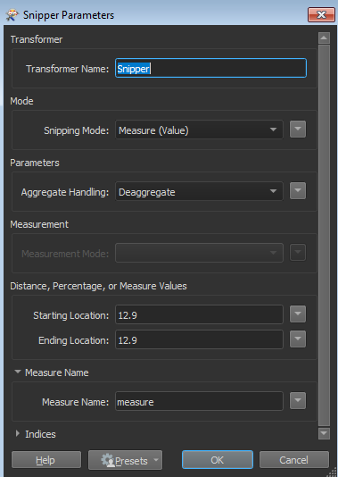
I have turned my roadnetwork in a LRS (linear referenced road network) with measures. Now I have a table with roadaccidents without coordinates, but with the measures corresponding to the LRS (e.g. km 12.90). Is it possible to locate these locations on the map, using the LRS, and thus find the coordinates? The best solution I've found so far is to extract the nearest measure values, but these dont get close enough.

Question
Can FME locate 'events' that only have a measure, but no coordinates, on a LRS


Reply
Rich Text Editor, editor1
Editor toolbars
Press ALT 0 for help
Helpful Members This Week


Enter your E-mail address. We'll send you an e-mail with instructions to reset your password.