Hi.
I have LiDAR data in .asc and .las formats. I also have .shp file points that I would like to attach the elevation from the LiDAR. How would I go about this?
Any help wold be much appreciated.
Paul


Hi.
I have LiDAR data in .asc and .las formats. I also have .shp file points that I would like to attach the elevation from the LiDAR. How would I go about this?
Any help wold be much appreciated.
Paul
Best answer by jdh
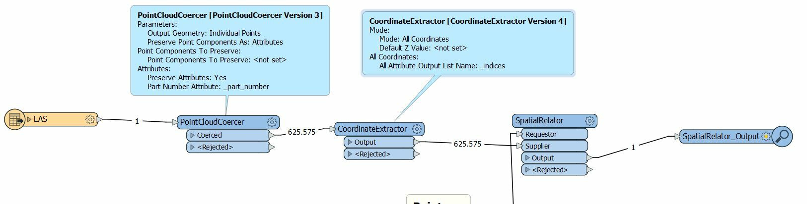
You can use a SurfaceDraper with your point cloud going to the Points/Lines port and your shapefile points going to the DrapeFeatures port.
The benefit to this method is that the point features don't need to correspond exactly to an element in the point cloud.
Enter your E-mail address. We'll send you an e-mail with instructions to reset your password.