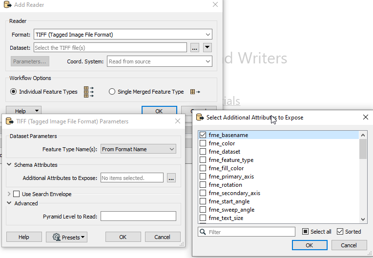
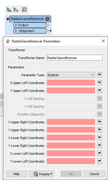
Hello every one. I have a folder with 700 .tiff raster files (images) and a external orientation text file with 700 rows of ID (name of the raster file), X, Y and rotation of the center point of each raster file. How could I convert all these in to geotiff? How do y manage to relate each row of the text file to its raster file? After this is solved I gess it should be easy to georeference them with the rastergeoreferencer...


Reply
Rich Text Editor, editor1
Editor toolbars
Press ALT 0 for help
Helpful Members This Week


Enter your E-mail address. We'll send you an e-mail with instructions to reset your password.