


I’m hoping to use a DTM service provided by the Environment Agency to extract the height for locations I have (points or polygons I haven’t decided yet). They provide WMS, WCS, WMTS, OGI API: LIDAR Composite Digital Terrain Model (DTM) - 1m
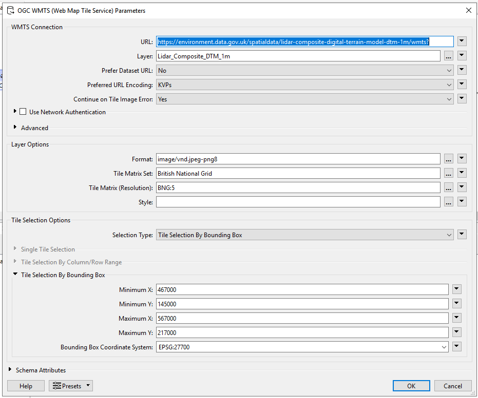
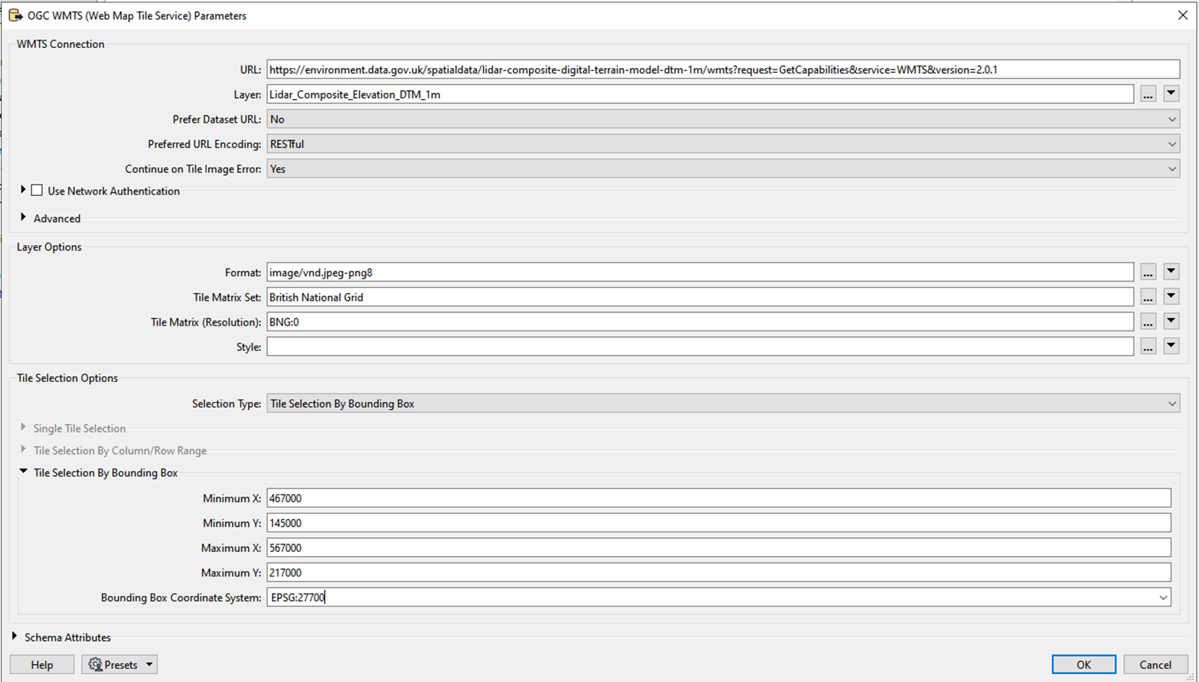
I believe it’s the WMTS I want, it has the elevation data layer within it. https://environment.data.gov.uk/spatialdata/lidar-composite-digital-terrain-model-dtm-1m/wmts?request=GetCapabilities&service=WMTS&version=2.0.1
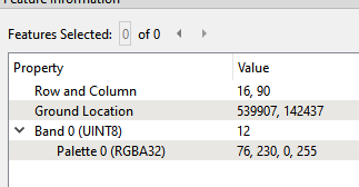
My plan was to use a WMTS reader, and the PointOnRasterValueExtractor to get the heights for the points I supply.
I can’t even seem to read in the WMTS data, because I’m not putting in the correct parameters?
- I’m not sure what format I need, or if it even matters for what I’m doing – vnd.jpeg-png8 seems to be the most versatile so that’s what I’ve been trying?
- Not sure what the Tile Matrix means? The different zoom levels, but I don’t know how I’d know what I need?
- I obviously don’t want to read in the entire WMTS service, so I’ve been trying with a bounding box in British National Grid min 467000,145000, 567000,217000, around London. This seems to be a supported CRS in the WMTS.
I’m getting the following error message, so maybe am I supposed to edit the URL I give for the WMTS? Perhaps I need to build the URL I am hitting to include a bit more, but I’m not sure how I dig through anything online to make sense of the service?
2025-06-03 11:56:53| 0.7| 0.0|ERROR |<WMTS> An error occurred while generating the GetTile URL, please check the dataset URL and selected parameters
Or am I going about this the wrong way and it’s a HTTPCALLER job rather than WMTS reader?
I am running FME Form 2023.2.4