Can I ask a quick imagery / coordinate conversion question?
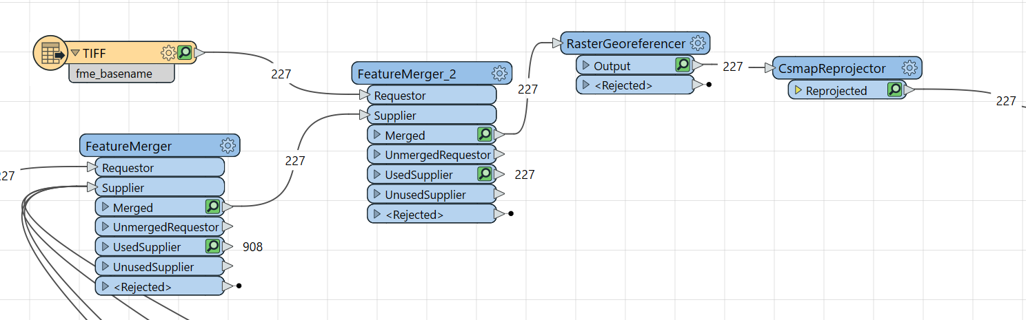
I have lots of historic imagery files, the imagery are all flat tif files, not georeferenced whatsoever. I also have the corresponding .IF files (never heard of IF files) as shown below which contain georeferencing information.
If I convert the tifs to geotiffs using the extent information below they all end up in Southern Ireland instead of Nottinghamshire UK. Any ideas what this Cassini projection is, or how to fix this….??
I need to get these files into 27700 British National Grid
I’ve never heard of .IF files either. What I would try is see if you can convert the IF files to WKT or a PROJ string and then use that as input for the PROJReprojector. The help of that transformer links to description of both of those formats.
We use 3 different kinds of cookies. You can choose which cookies you want to accept. We need basic cookies to make this site work, therefore these are the minimum you can select. Learn more about our cookies.