

Puzzle 1
The first puzzle (in fact, all of the puzzles in this set) requires the user to identify a mountain from a photographic image:
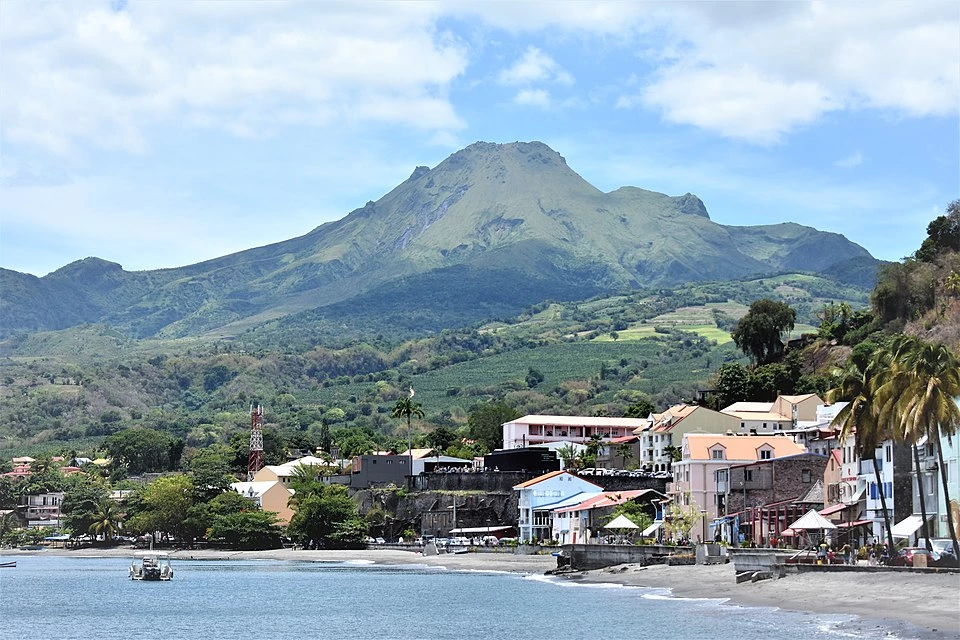
We know the island in the origin story is Martinique. We know this mountain is the highest point. Therefore we can easily look up the information to find that this is Mont Pelée.
So, enter Mont Pelée into the text field to receive the first clue.
Clue
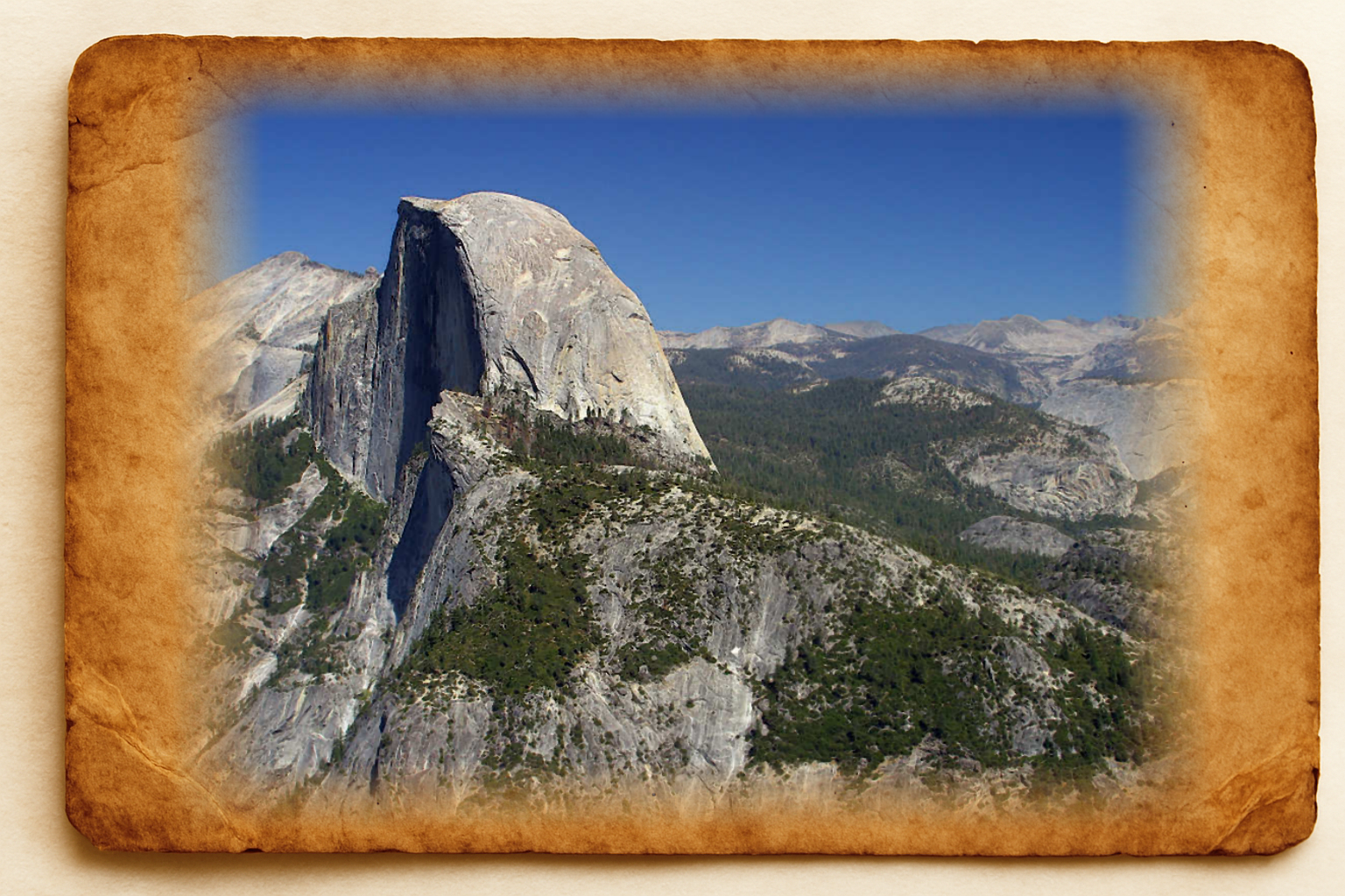
- The actual clue is an image. It is meant to represent somewhere in a specific continent. In this case it is an image of Half Dome mountain, in North America.
- Using an image like this means you have to also uncover where the image represents. We know it's meant to be a continent-level clue. But can you guess the continent from the image? It makes all of these clues a geoguessr-style puzzle in themselves!
Bonus Clue
- The bonus clue for this puzzle states: Use proper links to download data and images. Don’t rely on what you see on screen! It might not be the best resolution or full dataset.
- This is a reminder to always download images or data used in a puzzle. What is shown in a screenshot on the page might not be as accurate or complete.
Notes
- Alternative names for the mountain are Mont Pelée, Mount Pelée, or Montann Pèlé. All of these will work as correct answers.
- I was quite insistent that you include the accents on the characters. It was the first puzzle I set up so I was perhaps being over enthusiastic.
Puzzle 2
As with other puzzles in the Geography set, the idea is to identify a location given by a number of clues. This puzzle is another image of a mountain:
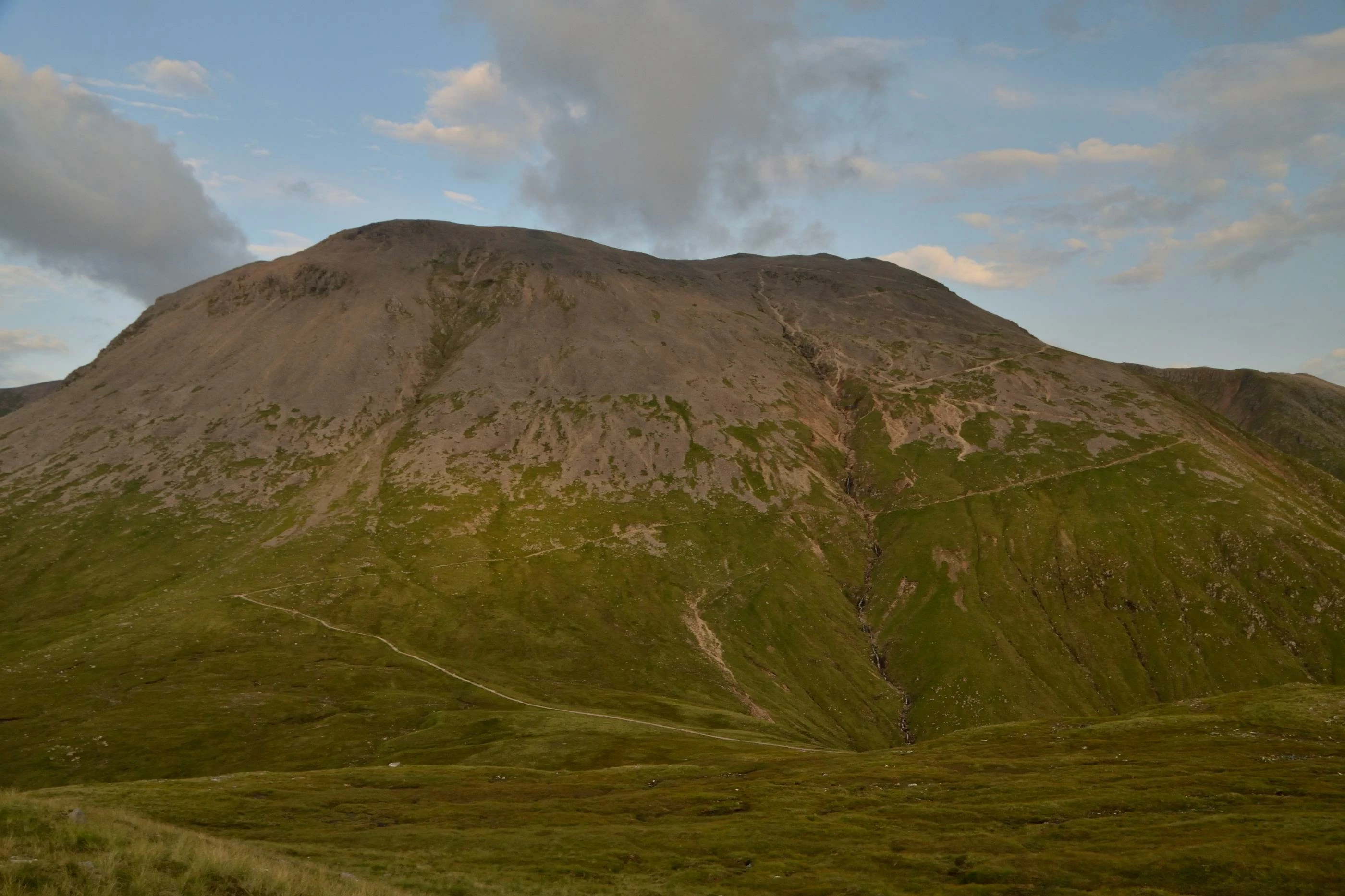
We have no idea where this mountain might be, but there is a clue which says to download the image and examine its "Engraver's eXtra Information Folio". This is a reference to EXIF data in an image, which often includes metadata about location.
This is where the previous bonus clue - to always download the data, not use the page version - is important. If you use the link provided, the file includes EXIF data. If you right-click and save the image, your browser may change the format and remove the EXIF data!
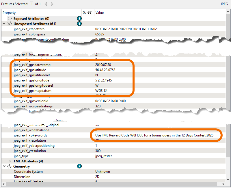
Using the EXIF GPS data, we can look on a map and find that this image is of Ben Nevis, the UK's highest mountain.
So, enter Ben Nevis into the text field to receive the second clue.
Clue
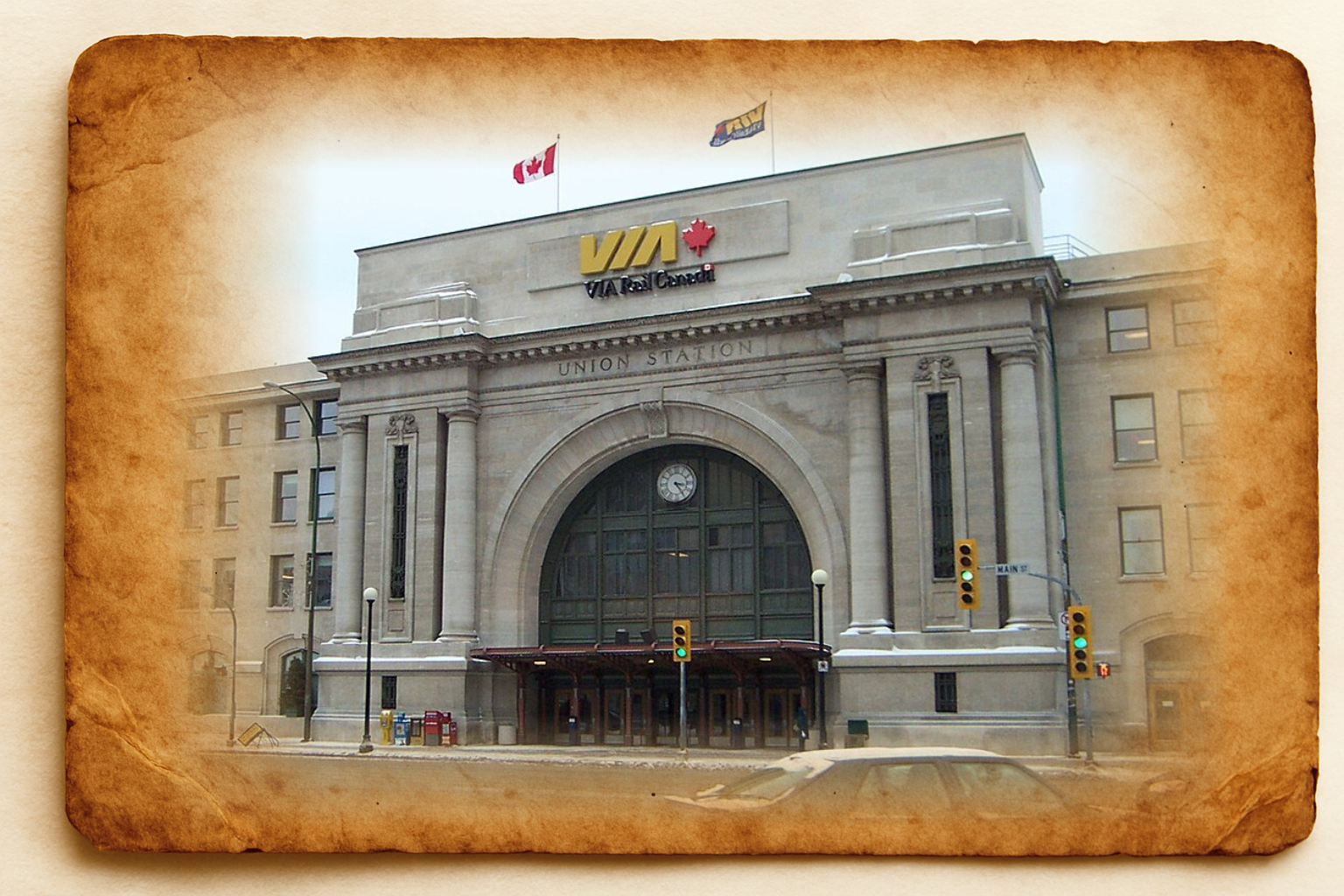
- The actual clue is another image. This time it is a country-level clue. The flag on the building easily identifies this as being in Canada.
- The actual building in the image is Union Station, in Winnipeg, Manitoba. We should ignore that, though, because this is a country-level clue.
Bonus Clue
- The bonus clue for this puzzle is: Code puzzles return clues in the form of coordinates. I think they are probably longitude first. But check in Google Earth.
- Basically, the code puzzles returned coordinates and it might not be clear whether they are in latitude/longitude or longitude/latitude format. This clue tells you that the format is the same as used in Google Earth (lat/long).
Notes
- Alternative names for the mountain are Ben Nevis and Beinn Nibheis, either of which would work as correct answers.
- Perhaps you recognized the mountain immediately? Or perhaps you identified is using AI? If so, you missed out! If you downloaded the image and inspected the EXIF data, there was a bonus guess code hidden in the exif keywords!
Puzzle 3
The third puzzle is another image of a mountain. However, in an attempt to defeat AI, this image has been converted to a hand-drawn monochrome:
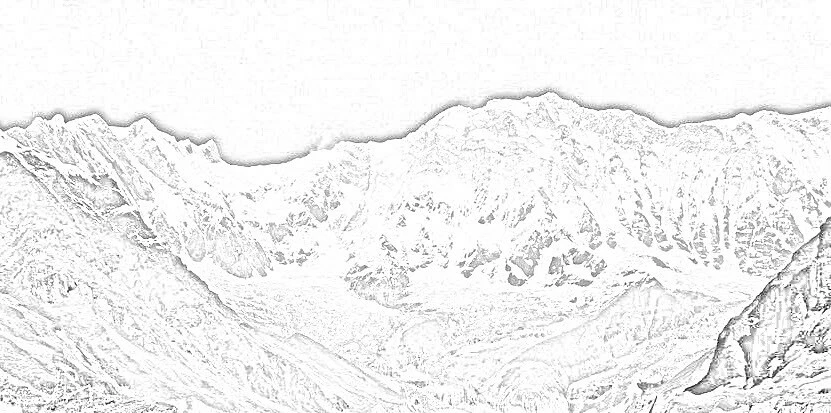
The important information to help identify the mountain comes in the puzzle's description:
There are three important clues in this text, but we can't tell you what three. Words are important to solve the problem, though. To solve this, you must search the world and find misaligned uncharted topiary.
Underlined are the important parts. "What Three Words" is a web service where geographic position is defined by three random words. The three words to search for are "misaligned uncharted topiary".
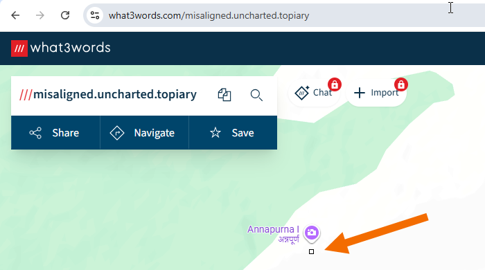
Which puts us right next to the Himalayan mountain, Annapurna.
So, enter Annapurna into the text field to receive the third clue.
Clue
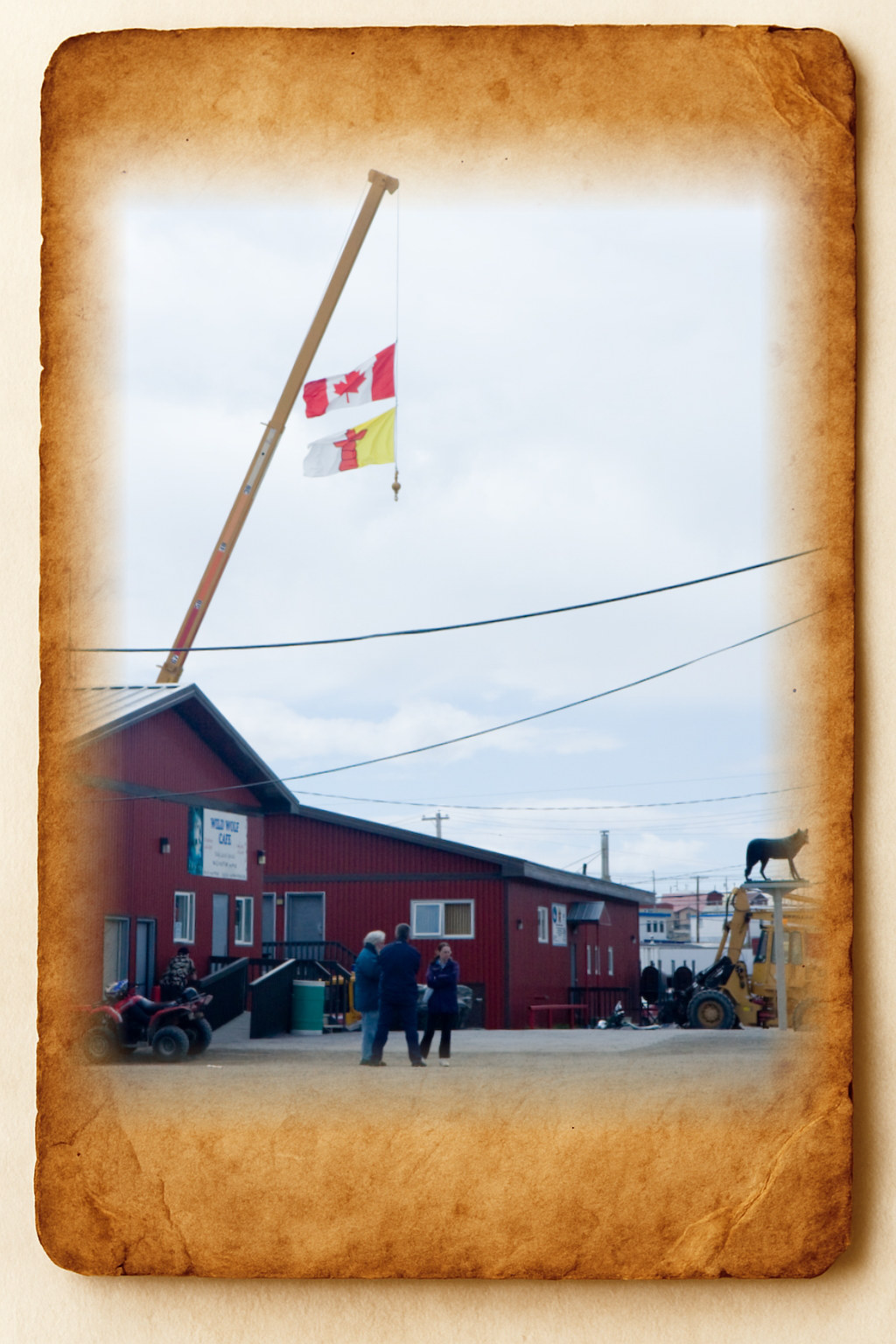
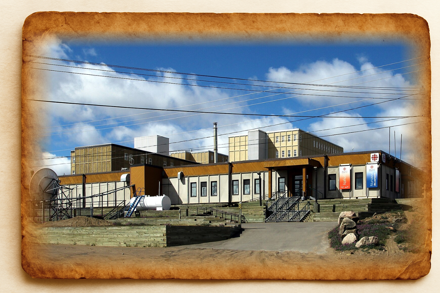
- The actual clue is another photographic image. It doesn't really matter where this is. More important is that is has both the Canadian flag (country) and Nunavut flag (province).
Bonus Clue
- The bonus clue for this puzzle states: Did you notice that each set of puzzles points to a different location? It's true. Why might that be?
- This means that each set of puzzles leads to a separate location - therefore they aren't clues to the overall treasure location.
Notes
- The name Annapurna means "everlasting food" in the local language.
- Annapurna was first climbed by a French team in 1950.
Puzzle 4
The next puzzle is provided in the form of a poem! The poem hides the identify of a mountain and is as follows:
Song of the Silent Giant
Mariner is he who glimpsed me first, adrift through crimson skies,
Once I was charted by eyes, that no sailor possessed.
Under twin Viking gazes I stood, unmoving, immense,
Never to wake that they could see, though fire still sleeps in my breast.
Tides of basalt, slow as centuries, built my throne,
Ages have etched my slopes with whispers of flame.
Isolate, older than oceans, colder than bone,
Name me, treasure searcher, if you dare speak my name.
The name of the mountain is Olympus Mons, the highest mountain in our solar system, located on Mars.
Mariner and Viking are two space expeditions that first noted the size of Olympus Mons, though it had been first discovered through telescopes in the 1800s. Olympus Mons is a volcano, made of basalt.
So, enter Olympus Mons into the text field to receive the fourth clue.
Clue
- The actual clue is a photograph of a building showing the name of the city: Iqaluit (the capital of Nunavut province).
Bonus Clue
- The bonus clue for this puzzle states: Another clue? OK, here's how it all connects up: Codes ⇔ FME. Images ⇔ Geography. Got it?
- This clue is meant to show how building a line between the Codes puzzle location and the FME puzzle location, will cross a line between the Images puzzle location and Geography puzzle location, to denote the treasure's resting place.
Notes
- I tried to write the puzzle as a question, but ChatGPT was able to solve it too easily. A poem - although generated by ChatGPT - was much harder for AI to solve!
Puzzle 5
The final puzzle requires the identification of a mountain through a series of clues:
Aside from the map (pictured above), there was also:
- A CSV dataset of climate data for the region
- An image that was meant to be a hint to the overall area
- A textfile dataset with some unexplained abbreviations
The data should have been interpreted as follows:
- The region is Vakaga province. The climate data shows a tropical climate, with no negative temperatures, and a rainy season around August. This is typical of central Africa.
- The mountain is part of the Bongo Massif, and the image is one of musical bongos.
- The mountain is actually located in the Central African Republic. The countries that surround CAR are Cameroon (CMR), Chad (TCD), Democratic Republic of the Congo (COD), Republic of the Congo (COG), Sudan (SDN), and South Sudan (SSD).
Using these clues you should have been able to identfy the mountain as Mont Toussoro in the Central African Republic.
So, enter Mont Toussoro into the text field to receive the final clue.
Clue
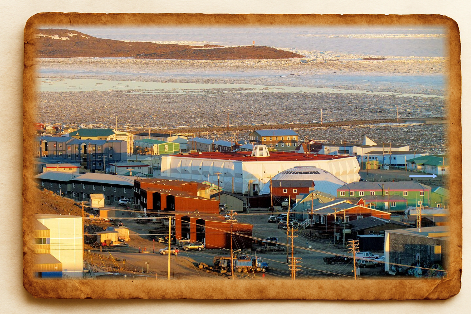
- The final clue is an image. It has an arrow marked on it to identify a specific point. You should already have known the image is of Iqaluit in Nunavut, Canada. This new image just identies the exact point in mind. The arrow is in light blue and hard to spot. Check the building on the right-hand side of the image.
Bonus Clue
- As a level 5 puzzle, there is no bonus clue here.
Notes
- I didn't have time to test this puzzle against AI processing. I was hopeful that the map was of such a small area that AI wouldn't have helped.