


Hello,
I’m using FME 2024.2 to read ORD DGN files stored in ProjectWise.
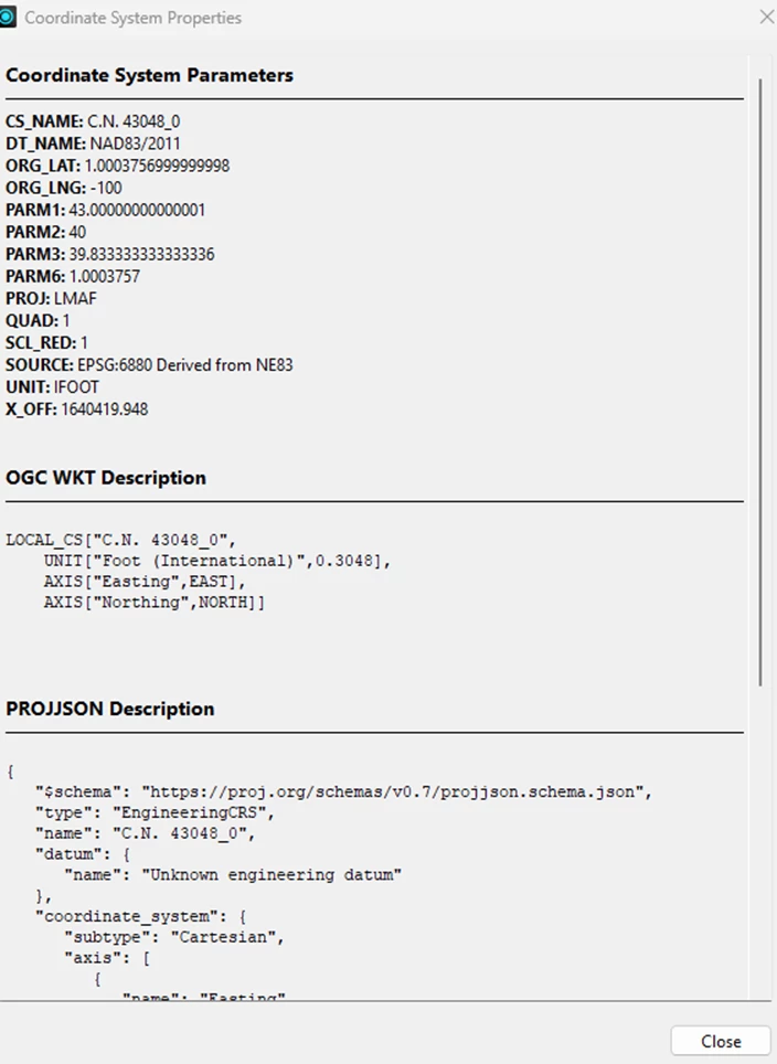
The DGN files have a local coordinate system (LCC) defined in ORD, but when I read them into FME, the detected GCS appears incorrect — particularly the ORG_LAT value. Because of that, when I try to set the coordinate system and reproject to State Plane, the transformation doesn’t work properly.
Has anyone encountered this issue before?
Does the GCS definition in ORD need to follow a specific format or standard to be recognized correctly by FME?
Any insight or suggestions would be greatly appreciated!
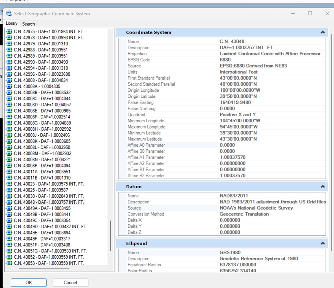
GCS shown for features in FME
")
