Solved

How to make an ArcGIS model in FME ?


Forum|alt.badge.img

hello!!

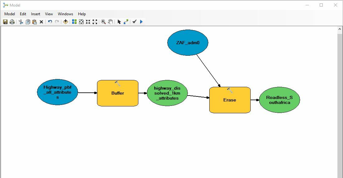
I am trying to build a model to find roadless area with FME.

Firstly, I want to do a buffer with an esri-file geodatabase format file which is highway feature, then I want to dissolve it by 1 km with some attributes. then I want to erase the layer from the administrative boundary layer.

Can I do this in FME ?Is anyone have any suggestion? thank you

Best answer by david_r

The logic should be very similar in FME, you can use the following transformers:

  • Bufferer
  • Dissolver
  • Clipper (=Erase in ArcGIS)
View original
Did this help you find an answer to your question?

2 replies

david_r
Evangelist
  • Best Answer
  • December 4, 2017

The logic should be very similar in FME, you can use the following transformers:

  • Bufferer
  • Dissolver
  • Clipper (=Erase in ArcGIS)

david_r
Evangelist
  • December 7, 2017

The Bufferer works in ground units, meaning that if your Higways dataset has a coordinate system specified in meters (e.g. UTM), then the Bufferer will use meters as the buffer size. In that case you could use a buffer size of 1000 meters = 1 km.

You could also use the GeographicBufferer which lets you specify the units, e.g. kilometers. To try and improve the speed of the Clipper, consider inserting a Dissolver between the Bufferer and the Clipper.


Cookie policy

We use cookies to enhance and personalize your experience. If you accept you agree to our full cookie policy. Learn more about our cookies.

 
Cookie settings