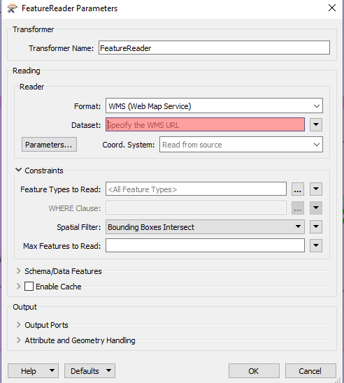
How could i access to topological map by feature reader format WMS ,

i am not sure ,where could i find WMS URL

https://danord.gdi-sh.de/viewer/resources/apps/Anonym/index.html?lang=de#/


and another point also i would like to know:

After reading the topological map .could i have acess to color ,if some lines or specific color in topological map that i do not want to show,what should i do ?


i would like to read the four choice at this site.

FME 2018 ,thanks in advance
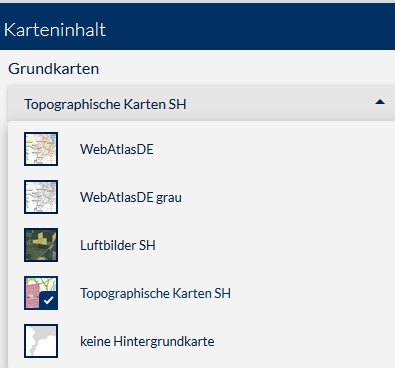
map-feature reader wms

You'll need to get in touch with the organisation running that site to see if they offer WMS services as well.

Keep in mind that when you're getting WMS you're just getting an image, so no option to turn specific features on or off (as people pointed out previously), you'll need a WFS for that.


You'll need to get in touch with the organisation running that site to see if they offer WMS services as well.

Keep in mind that when you're getting WMS you're just getting an image, so no option to turn specific features on or off (as people pointed out previously), you'll need a WFS for that.

thanks i understood it better


Steps to find services in webviewers:

  • Wait till the screen is loaded.
  • Press F12.
  • Zoom in one level.
  • Look for requests in the Network tab.


What I see is:

http://watkipw009.dpaorinp.de:6080/arcgis/rest/services/GEOBASISDATEN/DK_NL_EGG_cached/MapServer/WMTS/tile/1.0.0/GEOBASISDATEN_DK_NL_EGG_cached/default/default028mm/5/6/13" target="_blank">https://danord.gdi-sh.de/viewer/proxy?http://watkipw009.dpaorinp.de:6080/arcgis/rest/services/GEOBASISDATEN/DK_NL_EGG_cached/MapServer/WMTS/tile/1.0.0/GEOBASISDATEN_DK_NL_EGG_cached/default/default028mm/5/6/13

The thing is, the requests have start with "https://danord.gdi-sh.de/viewer/proxy?".  I believe they use a technique to prevent the service being used at another place than this viewer. 

thanks for ur suggestion ,which other site offer free access to wms ,topological map that i could use in fme .


thanks for ur suggestion ,which other site offer free access to wms ,topological map that i could use in fme .

Are you looking for a specific region or country?


thanks for ur suggestion ,which other site offer free access to wms ,topological map that i could use in fme .

i am looking for each cities (polygon ) in germany . please,it is important to me to find a soluton to cancel specific color in map .is it hard to extract colors ?


thanks for ur suggestion ,which other site offer free access to wms ,topological map that i could use in fme .

It can be (as was mentioned previously) very hard to extract specific colors out of an image. For the kind of things you want to do I would highly recommend using vector features, such as those coming from a WFS service instead.


Reply