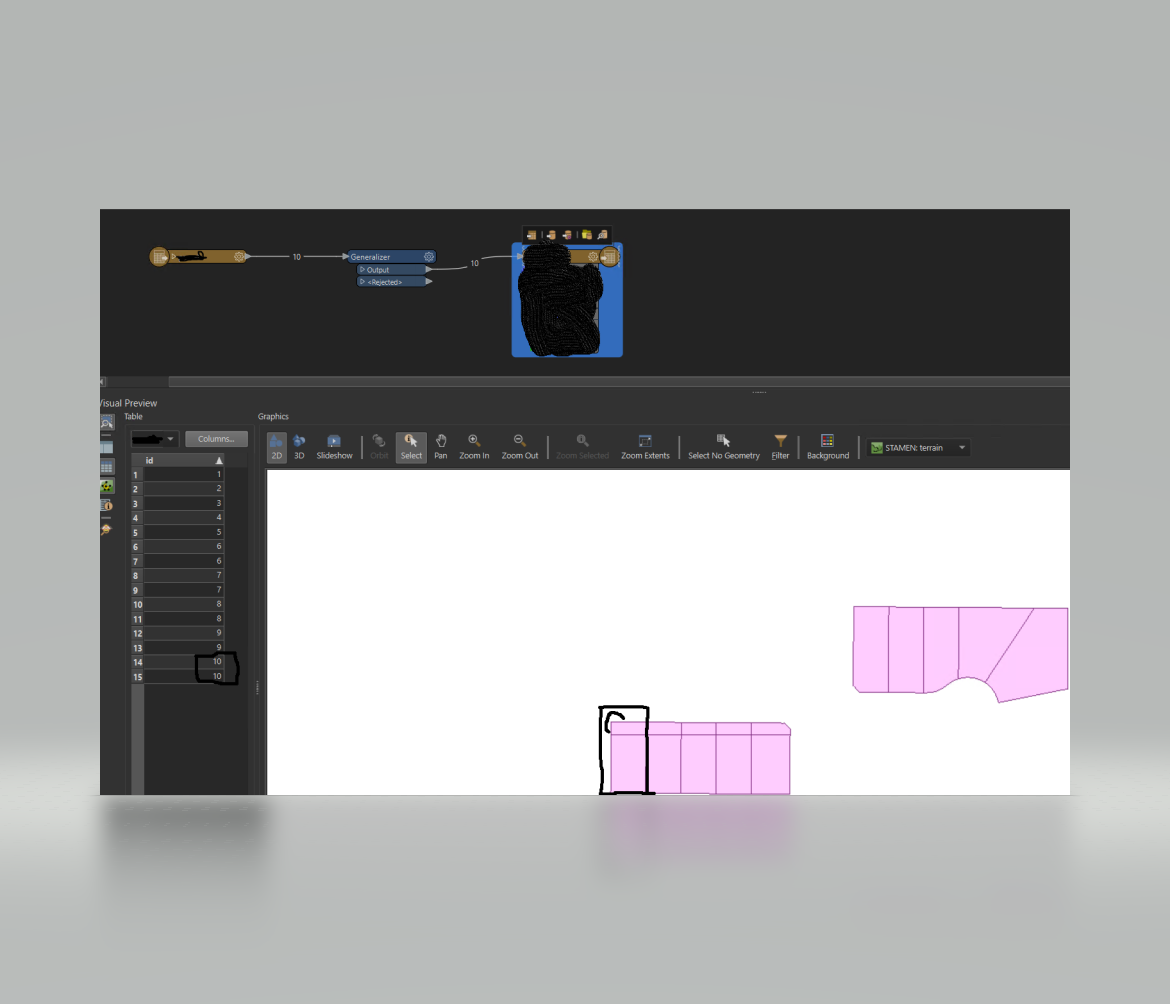
Hello, I am just a month or so into using this tool. I have a task that requires me to transform Geojson to the Mapbox Vector format so we can use on our mapbox tileserver - min zoom 15/18 with about 4 or so attributes. I am told Mapbox requires a uniqueId and so I am providing it in an integer format.
Within this task, there are only 10 simple 'house shapes' from the GeoJson dataset.
I am required to provide the unique id for each parcel within so I am perplex why 10 rows of data convert into 15 just using the following base design (omitted functional details)
NOTE: Id 10 is duplicated and the smaller shape is created out of thin air.
If there is a generalizer that can remove that I have not been able to find it.
However, if I change my min/max zoom - remove the generalizer it works with 10 rows. Min/Max 7/15
The min/max requirement is solid and they want it rendered exact.
Am I over complicating please let me know. Thank you,

