Hello, I'm experiencing difficulty transforming a .las file to Mojang Minecraft format, as I receive an error stating that the Z coordinates exceed the allowed parameters (0-255). I've found no straightforward way to manually set the maximums and minimums before transforming. I've tried to scale the .las, but the feature is imprecise and results in distorted structures. ​Is there a way to set minimum and maximum coordinates prior to transforming?

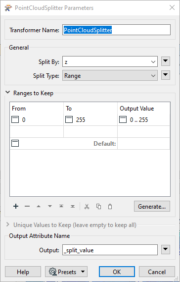
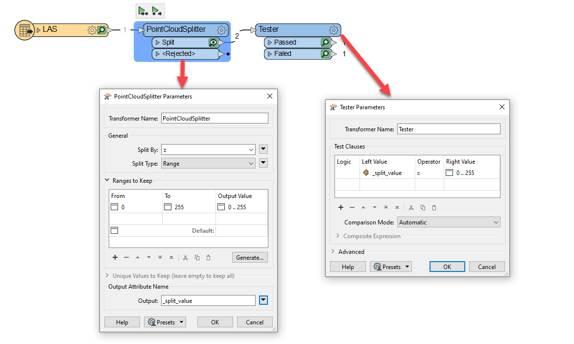
Hi @shibboleth​ you could try using the PointCloudSplitter to split the PointCloud by it's Z coordinates. You can set the parameters as follows:

imageNext, use a Tester transformer to filter out only the feature that have a _split_value of 0' .. 255'.

Additionally, if you're looking at how transform a Point Cloud to the Mojang Minecraft Format, I recommend taking a look at our article on How to Make Minecraft Worlds. There's a section on transforming a LAS file to the Minecraft Format that you can use as a reference.

Hi @danminneyatsaf​, thank you for the reply! I attempted this, and it appeared the point cloud was processed successfully by the splitter; However, there was nothing output from the tester.
 

tester


Hi @danminneyatsaf​, thank you for the reply! I attempted this, and it appeared the point cloud was processed successfully by the splitter; However, there was nothing output from the tester.


tester

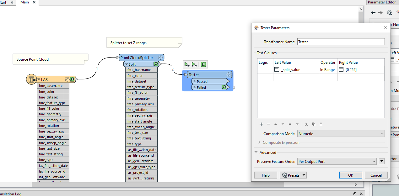
@shibboleth​ here's a screenshot of my parameters. You'll want to check for the value output by the PointCloudSplitter in the Tester instead of testing for a range.

image


Hi @danminneyatsaf​, thank you for the reply! I attempted this, and it appeared the point cloud was processed successfully by the splitter; However, there was nothing output from the tester.


tester

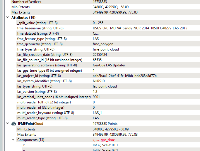
@danminneyatsaf​ That's helpful, thank you. The error I'm encountering is that the splitter successfully appends the _split_value, but it doesn't seem to have an effect on the minimum and maximum extents of the Point Cloud, which causes a Z-range error when writing to the Minecraft transformer.


Workbench SetupTester PassedMinecraft Mojang Writer Failure


Hi @danminneyatsaf​, thank you for the reply! I attempted this, and it appeared the point cloud was processed successfully by the splitter; However, there was nothing output from the tester.


tester

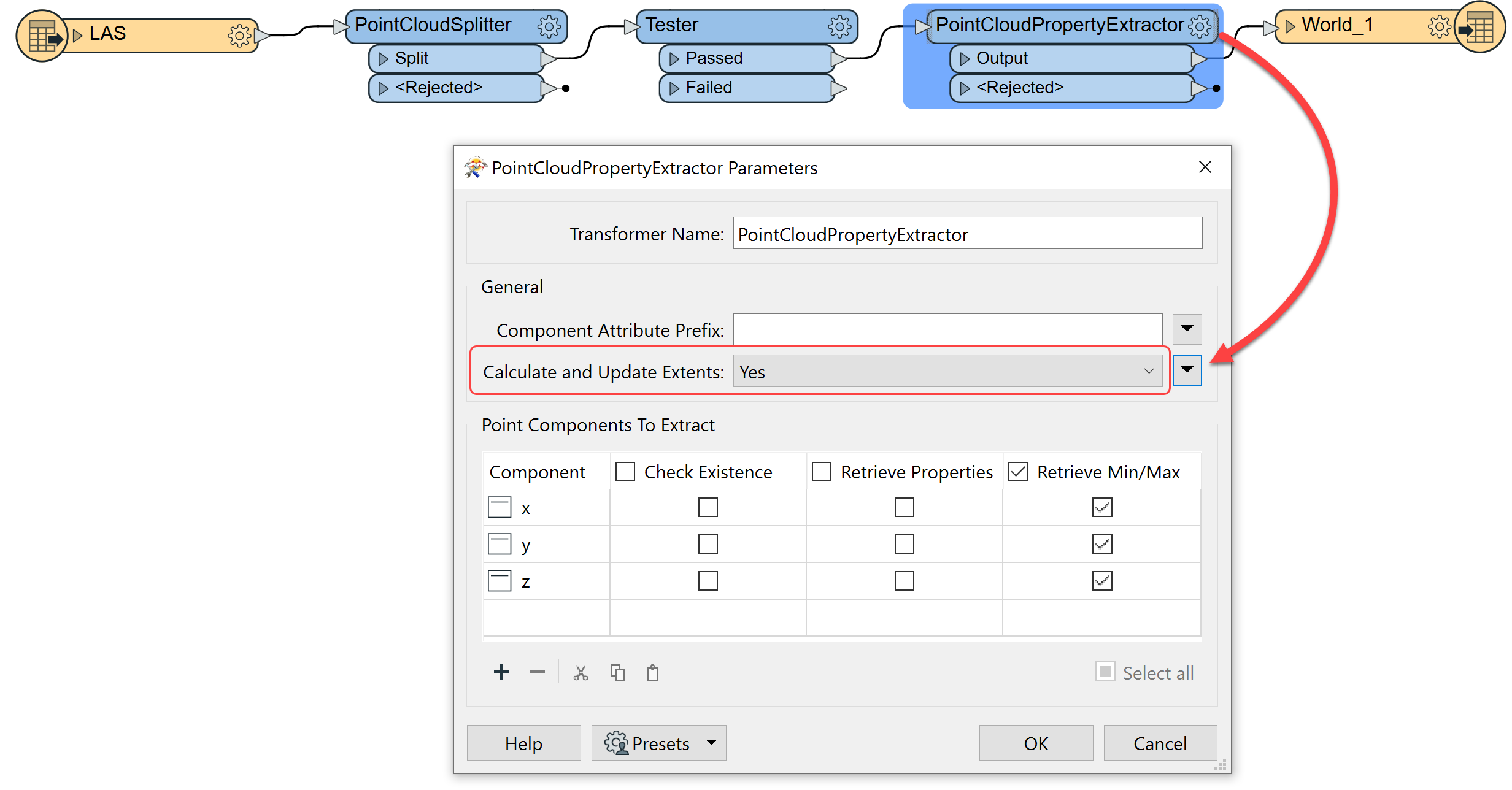
@shibboleth​ Adding a PointCloudPropertyExtractor transformer will fix this. Set Calculate and Update Extents to Yes and it will update the point cloud extents to those created by the PointCloudSplitter. Now your point cloud should contain extents that are within those required by the Minecraft Writer.


Hi @danminneyatsaf​, thank you for the reply! I attempted this, and it appeared the point cloud was processed successfully by the splitter; However, there was nothing output from the tester.


tester

@danminneyatsaf​ Thank you for the reply. Apologies for the incessant questions, but where would I place the PointCloudPropertyExtractor? I've used the transformer before, but I couldn't find a way to override the extents.


Hi @danminneyatsaf​, thank you for the reply! I attempted this, and it appeared the point cloud was processed successfully by the splitter; However, there was nothing output from the tester.


tester

@shibboleth​ you can insert it right after the Tester. I made an edit above in my previous comment mentioning that you'll need to change the Calculate and Update Extents parameter in the PointCloudPropertyExtractor to Yes. I've attached a sample workspace to this reply for reference.
image


Hi @danminneyatsaf​, thank you for the reply! I attempted this, and it appeared the point cloud was processed successfully by the splitter; However, there was nothing output from the tester.


tester

This works! Now I'm on to learn how to map each layer to different block IDs, which I believe is detailed in the tutorial you linked in a previous reply. Thank you so much for your help!


Reply