i have OSM (Openstreetmaps) in shape file and i have found at inspector that it has no color so i would like to color it and get cartographic output that includes suitable color for the map .but i am new in Fme and i am not sure which parmeter should i define at MAPnikRastersizer transformer .

is there any method to download the map from openstreetmap ,including the suitable color as Google maps .


also i would like to know ,how could i extract specific polygon from lots of polygons in OSM .

FME 2018

Thanks in advance
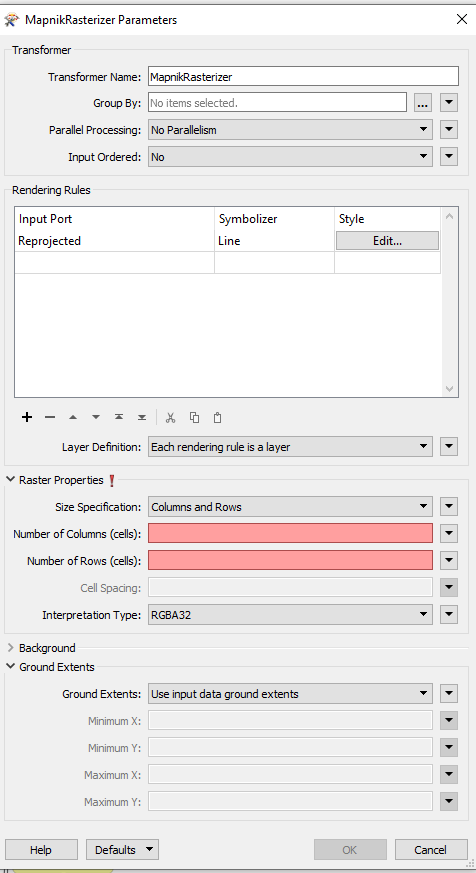
 

MAPnikRastersizer 


Can you elaborate what you want to do? Like the question behind this question.

Do you want to recreate a full basemap from scratch?

Do you need a reference image behind an object for a report?


Can you elaborate what you want to do? Like the question behind this question.

Do you want to recreate a full basemap from scratch?

Do you need a reference image behind an object for a report?

i need to have background map for specific city ,so i need reference image behind an object that is exactly what i want to get . could u advice me ,what should i do and thanks


i need to have background map for specific city ,so i need reference image behind an object that is exactly what i want to get . could u advice me ,what should i do and thanks

Let's take "forest" as an example.

  1. Figure out where it is in the source data. Probably in the "landuse" or "natural" categories.
  2. Use a TestFilter to filter out polygons which are forests
  3. Route them to the MapnikRasterizer, it'll automatically create an input port for it when you connect to it.
  4. Set up the MapnikRasterizer to style the forests the way you like

And then repeat it for all the other things you want to map.


Word of warning though, this is not going be an easy process! It will take time and it will take a lot of effort, trial and error. I would highly recommend to go through some of the modules on the FME Academy first to give you a better understanding of how FME works. Specifically the Integrate Data with the FME Platform part.


i need to have background map for specific city ,so i need reference image behind an object that is exactly what i want to get . could u advice me ,what should i do and thanks

Thanks ,i will read more about integrate Data with FME Platform


Reply